Approximate Location Map
Large Map »
Latitude: 51.5837 / 51°35'1"N
Longitude: -2.9997 / 2°59'58"W
OS Eastings: 330832
OS Northings: 187674
OS Grid: ST308876
Mapcode National: GBR J5.CJ5T
Mapcode Global: VH7BC.YGK9
Plus Code: 9C3VH2M2+F4
Entry Name: 5, Clifton Place
Listing Date: 2 May 1980
Last Amended: 31 March 2000
Grade: II
Source: Cadw
Source ID: 23144
Building Class: Domestic
ID on this website: 300023144
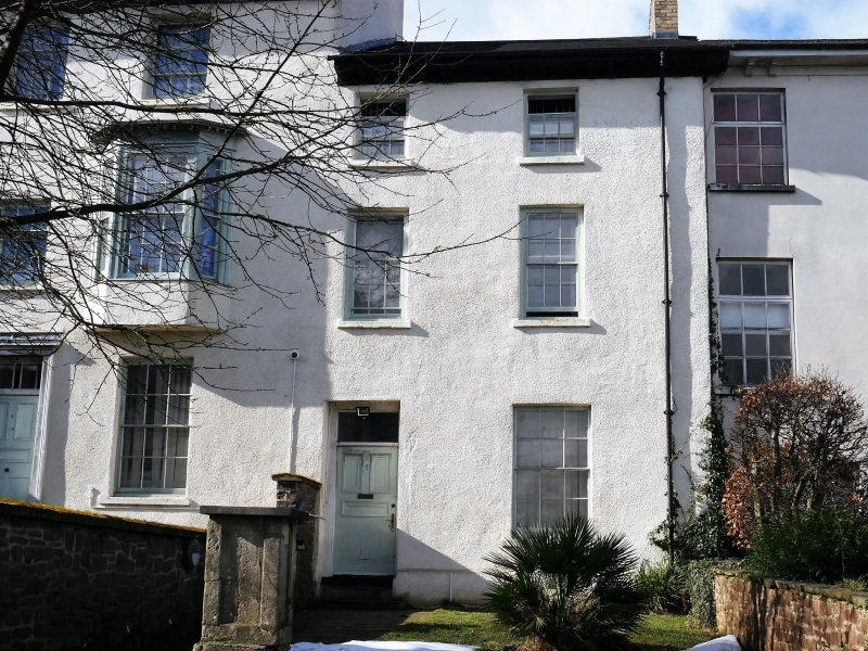
Location: One of a run of stucco houses on the W side of street, beginning at Clifton Road.
County: Newport
Community: Stow Hill
Community: Stow Hill
Built-Up Area: Newport
Traditional County: Monmouthshire
Tagged with: Building
Clifton Place was built up from circa 1840 onwards.
Three storey, two window house. Stucco, slate roof, bracketed eaves. On upper floor, two 9-pane sash windows; on first floor two 12-pane sashes. On ground floor, 12-pane sash window to R of doorway with, rectangular overlight, panelled door.
One of a group of earlier C19 houses forming W side of Clifton Place. Group value with adjacent listed houses.
External links are from the relevant listing authority and, where applicable, Wikidata. Wikidata IDs may be related buildings as well as this specific building. If you want to add or update a link, you will need to do so by editing the Wikidata entry.


Other nearby listed buildings
