Approximate Location Map
Large Map »
Latitude: 51.7636 / 51°45'48"N
Longitude: -4.6235 / 4°37'24"W
OS Eastings: 219052
OS Northings: 210467
OS Grid: SN190104
Mapcode National: GBR GH.00FN
Mapcode Global: VH2P7.TX2X
Plus Code: 9C3QQ97G+CH
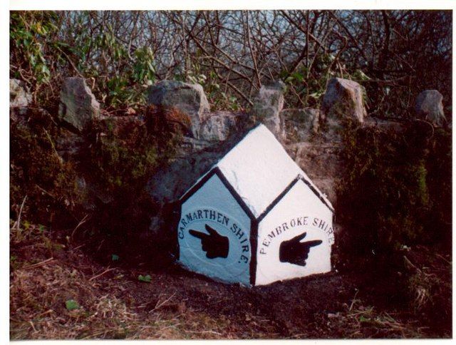
Entry Name: Boundary stone near Castle Ely Bridge
Listing Date: 12 January 2001
Last Amended: 12 January 2001
Grade: II
Source: Cadw
Source ID: 24493
Building Class: Civil
ID on this website: 300024493
Location: Situated at Castle Ely Bridge on the SE side of the former A477 (now by-passed to N), approximately 1km E of Llanteg.
County: Pembrokeshire
Town: Whitland
Community: Amroth
Community: Amroth
Locality: Castle Ely
Traditional County: Pembrokeshire
Tagged with: Boundary marker
Early C19 county boundary stone.
Boundary stone, grey limestone, canted front with two triangular headed faces and a sloping lozenge-shaped sloping top. The two faces have the county names Pembrokeshire and Carmarthenshire in incised letters curved over a low relief hand with pointing finger.
Included as a well-lettered county boundary stone of the early C19.
External links are from the relevant listing authority and, where applicable, Wikidata. Wikidata IDs may be related buildings as well as this specific building. If you want to add or update a link, you will need to do so by editing the Wikidata entry.


Other nearby listed buildings
