Approximate Location Map
Large Map »
Latitude: 51.602 / 51°36'7"N
Longitude: -3.3413 / 3°20'28"W
OS Eastings: 307197
OS Northings: 190091
OS Grid: ST071900
Mapcode National: GBR HQ.B887
Mapcode Global: VH6DK.1ZFS
Plus Code: 9C3RJM25+QF
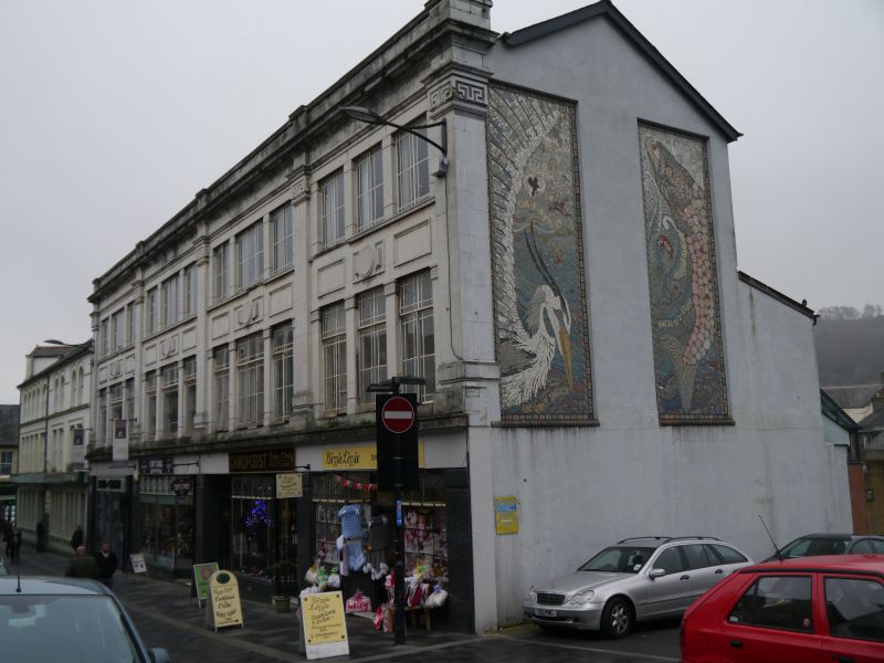
Entry Name: 8, Church Street, Pontypridd, Popntypridd, CF37 2TH
Listing Date: 17 July 1990
Last Amended: 26 February 2001
Grade: II
Source: Cadw
Source ID: 24893
Building Class: Commercial
ID on this website: 300024893
Location: Opposite Pontypridd Market
County: Rhondda Cynon Taff
Town: Popntypridd
Community: Pontypridd
Community: Pontypridd
Built-Up Area: Pontypridd
Traditional County: Glamorgan
Tagged with: Architectural structure
Built by the Co-operative Retail Society in a simplified classical style with Art Deco influence on a grid pattern, characteristic of the 1920s.
Listed for architectural interest as a good design in inter-war classicism, and for group value with the Old Market Hall, Market Chambers and The Arcade.
External links are from the relevant listing authority and, where applicable, Wikidata. Wikidata IDs may be related buildings as well as this specific building. If you want to add or update a link, you will need to do so by editing the Wikidata entry.


Other nearby listed buildings
