Approximate Location Map
Large Map »
Latitude: 51.8165 / 51°48'59"N
Longitude: -2.713 / 2°42'46"W
OS Eastings: 350947
OS Northings: 213337
OS Grid: SO509133
Mapcode National: GBR FL.WMNP
Mapcode Global: VH86T.XLLT
Plus Code: 9C3VR78P+JR
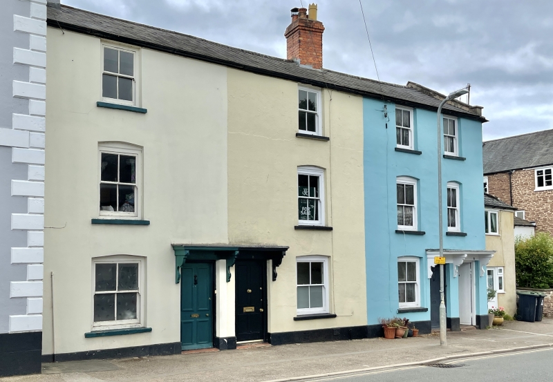
Entry Name: 10, North Parade
Listing Date: 15 August 1974
Last Amended: 10 August 2005
Grade: II
Source: Cadw
Source ID: 85016
ID on this website: 300085016
Location: On the main road going north out of Monmouth which rises slowly above the town.
County: Monmouthshire
Town: Monmouth
Community: Monmouth (Trefynwy)
Community: Monmouth
Built-Up Area: Monmouth
Traditional County: Monmouthshire
Tagged with: Building
Terrace of three early C19 houses.
Interior not seen at resurvey.
Included for its special architectural interest as a terrace of early C19 houses with definite character, having strong group value in Hereford Road.
External links are from the relevant listing authority and, where applicable, Wikidata. Wikidata IDs may be related buildings as well as this specific building. If you want to add or update a link, you will need to do so by editing the Wikidata entry.


Other nearby listed buildings
