Approximate Location Map
Large Map »
Latitude: 51.8159 / 51°48'57"N
Longitude: -2.7118 / 2°42'42"W
OS Eastings: 351029
OS Northings: 213270
OS Grid: SO510132
Mapcode National: GBR FL.WV93
Mapcode Global: VH86T.YM79
Plus Code: 9C3VR78Q+97
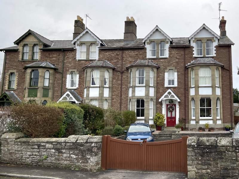
Entry Name: 21, Monkswell Road
Listing Date: 10 August 2005
Last Amended: 10 August 2005
Grade: II
Source: Cadw
Source ID: 85064
ID on this website: 300085064
Location: A residential road on the north side of the town reached off Hereford Road.
County: Monmouthshire
Town: Monmouth
Community: Monmouth (Trefynwy)
Community: Monmouth
Built-Up Area: Monmouth
Traditional County: Monmouthshire
Tagged with: Building
Mid to late C19 terrace, probably c1880; unaltered to the front elevation. Shown as Claremont on 1881 O.S. map.
Interior not seen at resurvey.
Included for its special interest as part of a mid-Victorian housing development of definite character to the north of Monmouth town centre.
External links are from the relevant listing authority and, where applicable, Wikidata. Wikidata IDs may be related buildings as well as this specific building. If you want to add or update a link, you will need to do so by editing the Wikidata entry.


Other nearby listed buildings
