Approximate Location Map
Large Map »
Latitude: 51.9462 / 51°56'46"N
Longitude: -3.3877 / 3°23'15"W
OS Eastings: 304718
OS Northings: 228431
OS Grid: SO047284
Mapcode National: GBR YP.MGBV
Mapcode Global: VH6BZ.7BFW
Plus Code: 9C3RWJW6+FW
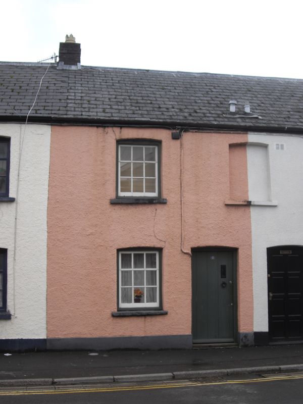
Entry Name: 13, Free Street
Listing Date: 16 December 1976
Last Amended: 4 November 2005
Grade: II
Source: Cadw
Source ID: 85613
ID on this website: 300085613
Location: On SE side of Free Street, near junction with Little Free Street.
County: Powys
Town: Brecon
Community: Brecon (Aberhonddu)
Community: Brecon
Built-Up Area: Brecon
Traditional County: Brecknockshire
Tagged with: Building
Early-to-mid C19.
No 13 has ledged door.
Listed a good group of earlier C19 houses retaining overall character.
External links are from the relevant listing authority and, where applicable, Wikidata. Wikidata IDs may be related buildings as well as this specific building. If you want to add or update a link, you will need to do so by editing the Wikidata entry.


Other nearby listed buildings
