Approximate Location Map
Large Map »
Latitude: 51.9501 / 51°57'0"N
Longitude: -3.3911 / 3°23'27"W
OS Eastings: 304491
OS Northings: 228870
OS Grid: SO044288
Mapcode National: GBR YP.M7GY
Mapcode Global: VH6BZ.57MW
Plus Code: 9C3RXJ25+2H
Entry Name: 89, The Struet
Listing Date: 31 May 1961
Last Amended: 4 November 2005
Grade: II
Source: Cadw
Source ID: 85731
ID on this website: 300085731
Location: Part of a block running S from the Bull's Head.
County: Powys
Town: Brecon
Community: Brecon (Aberhonddu)
Community: Brecon
Built-Up Area: Brecon
Traditional County: Brecknockshire
Tagged with: Building
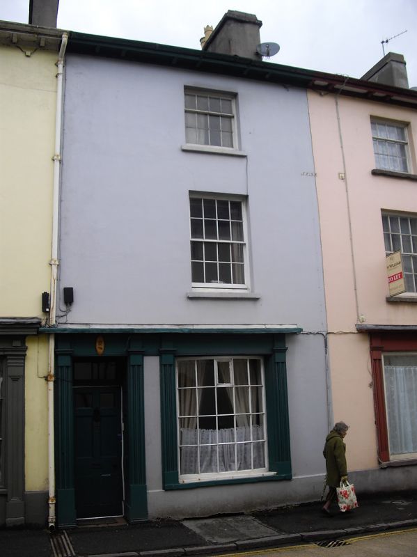
Early C19, probably, and part of same block as the Bull's Head.
No.89 has one-window front. Sash windows 4 panes wide in plain reveals on both second and first floors.
C19 shop front with small-pane bow window; casing of fluted pilasters fascia and cornice and with six-panelled door; panelled reveals and rectangular overlight.
Well-preserved block of early C19 shops with Group Value with adjacent listed buildings.
External links are from the relevant listing authority and, where applicable, Wikidata. Wikidata IDs may be related buildings as well as this specific building. If you want to add or update a link, you will need to do so by editing the Wikidata entry.


Other nearby listed buildings
