Approximate Location Map
Large Map »
Latitude: 51.9499 / 51°56'59"N
Longitude: -3.3912 / 3°23'28"W
OS Eastings: 304485
OS Northings: 228853
OS Grid: SO044288
Mapcode National: GBR YP.M7GZ
Mapcode Global: VH6BZ.58L0
Plus Code: 9C3RWJX5+XG
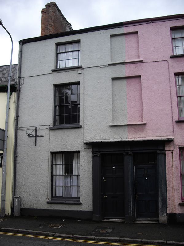
Entry Name: 92, The Struet
Listing Date: 31 May 1961
Last Amended: 4 November 2005
Grade: II
Source: Cadw
Source ID: 85738
ID on this website: 300085738
Location: About 30m south of the Bull's Head.
County: Powys
Town: Brecon
Community: Brecon (Aberhonddu)
Community: Brecon
Built-Up Area: Brecon
Traditional County: Brecknockshire
Tagged with: Building
Probably early C19.
Believed to retain good unaltered interiors.
An early C19 pair of houses with intact Georgian character and Group Value with adjacent listed properties in the Struet.
External links are from the relevant listing authority and, where applicable, Wikidata. Wikidata IDs may be related buildings as well as this specific building. If you want to add or update a link, you will need to do so by editing the Wikidata entry.


Other nearby listed buildings
