Approximate Location Map
Large Map »
Latitude: 51.823 / 51°49'22"N
Longitude: -3.0195 / 3°1'10"W
OS Eastings: 329829
OS Northings: 214309
OS Grid: SO298143
Mapcode National: GBR F5.W9NK
Mapcode Global: VH796.MF2V
Plus Code: 9C3RRXFJ+55
Entry Name: 67, Frogmore Street
Listing Date: 10 November 2005
Last Amended: 10 November 2005
Grade: II
Source: Cadw
Source ID: 86863
ID on this website: 300086863
Location: Situated on the main commercial street which runs from south-east to north-west across Abergavenny.
County: Monmouthshire
Town: Abergavenny
Community: Abergavenny (Y Fenni)
Community: Abergavenny
Built-Up Area: Abergavenny
Traditional County: Monmouthshire
Tagged with: Building
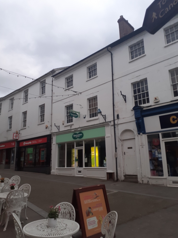
Built in the early C19, probably together with No. 65 adjoining, and has no visible evidence of earlier origin, late C20 shopfront. The frontage is said to have been completely rebuilt in the late C20, but is probably a reproduction.
Plain rendered frontage, probably over brick, Welsh slate roof with red brick stack. Double depth plan. Three storeys, three windows. Late Victorian style modern shopfront with central doorway, part glazed door, panelled stallriser, 2-light display windows, panelled pilasters and deep fascia. The windows above are 8 over 8 pane sashes on the first floor and 4 over 8 on the second floor, all with keyed heads. Second floor and eaves bands, plain roof with stack to right gable.
Rear elevation both plain and altered.
Interior not seen at resurvey except that the ground floor has no visible historic features.
Included for its special interest as part of a distinctive and varied group of early/mid C19 buildings which has strong group value at the top of Frogmore Street.
External links are from the relevant listing authority and, where applicable, Wikidata. Wikidata IDs may be related buildings as well as this specific building. If you want to add or update a link, you will need to do so by editing the Wikidata entry.


Other nearby listed buildings
