Approximate Location Map
Large Map »
Latitude: 51.3896 / 51°23'22"N
Longitude: 0.3984 / 0°23'54"E
OS Eastings: 566968
OS Northings: 168343
OS Grid: TQ669683
Mapcode National: GBR NN5.ZF5
Mapcode Global: VHJLR.VBGL
Plus Code: 9F3299QX+R8
Entry Name: Cobham College
Listing Date: 28 August 2000
Grade: I
Source: Historic England
Source ID: 1096317
English Heritage Legacy ID: 356743
ID on this website: 101096317
Location: Cobham, Gravesham, Kent, DA12
County: Kent
District: Gravesham
Civil Parish: Cobham
Built-Up Area: Cobham
Traditional County: Kent
Lieutenancy Area (Ceremonial County): Kent
Church of England Parish: Cobham St Mary Magdalene
Church of England Diocese: Rochester
Tagged with: Historic building
TQ 66 NE COBHAM THE STREET
(South side)
10/5/17
Cobham Cottage
28.08.1952 I
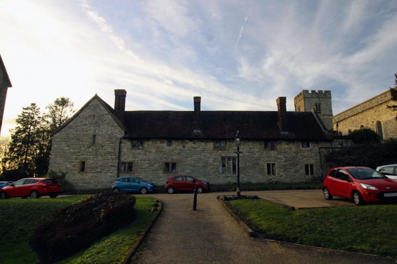
Founded in 1362 by Sir John de Cobham as a chantry for 5 priests. Surrendered to the Crown in 1539. Refounded as almshouses by the will of a later Lord Cobham and completed in 1598. The original building may have been designed by Henry Yvele. Now contains the almshouses and forms a quadrang of 2 storeys with a hall occupying the south side. The remaining sides are of coursed stone on inner and outer faces, but the Hall is faced in flint. The chimneys are of brick, 2 being modern. The roofs are tiled and gabled. The hall has 3 windows facing the quadrangle the other sides have 5 each. Windows are casements with stone mullions. The Hall has 2 outer windows in Perpendicular style. Door openings are arched on the doors in stone with brass plates naming the parish electing each pensioner. A timber porch with a now slanting tiled roof gives access to east end of the Hall from the south and to the undercroft. The Hall internally has a hooded stone fireplace of 1598 and a fine C14 timber roof. In
stone the undercroft is a square pillar supporting the original central hearth. The College is separated from the parish church by an open processional passageway with ruined arch at each end and the college buildings were once connected with the chancel. To the south are the remains of a building believed to have been a kitchen. In the centre of the south side of the quadrangle is a pump beneath a tablet recording its installation by the Countess of Darnley in 1824. A round-headed stone archway in the ruined building to the south has a tablet above it recording the refounding of the college as almshouses in the late C16.
Listing NGR: TQ6700468398
External links are from the relevant listing authority and, where applicable, Wikidata. Wikidata IDs may be related buildings as well as this specific building. If you want to add or update a link, you will need to do so by editing the Wikidata entry.


Other nearby listed buildings
