Approximate Location Map
Large Map »
Latitude: 52.5729 / 52°34'22"N
Longitude: -0.2385 / 0°14'18"W
OS Eastings: 519475
OS Northings: 298691
OS Grid: TL194986
Mapcode National: GBR HZQ.LJZ
Mapcode Global: WHHNK.9LPD
Plus Code: 9C4XHQF6+5J
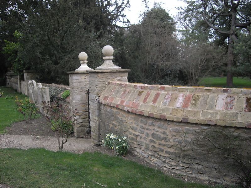
Entry Name: Wall and Gatepiers to the Vineyard
Listing Date: 7 May 1973
Grade: II
Source: Historic England
Source ID: 1161512
English Heritage Legacy ID: 49648
ID on this website: 101161512
Location: Peterborough, Cambridgeshire, PE1
County: City of Peterborough
Electoral Ward/Division: Central
Parish: Non Civil Parish
Built-Up Area: Peterborough
Traditional County: Northamptonshire
Lieutenancy Area (Ceremonial County): Cambridgeshire
Tagged with: Wall
PETERBOROUGH
1.
1500
PRECINCTS
Wall and Gate piers to
The Vineyard
TL 1998 NW 1/357A
II
2.
Wall and 3 sets of gate piers in rubble, 2 with ball finials. C19 and modern.
Listing NGR: TL1947598691
External links are from the relevant listing authority and, where applicable, Wikidata. Wikidata IDs may be related buildings as well as this specific building. If you want to add or update a link, you will need to do so by editing the Wikidata entry.


Other nearby listed buildings
