Approximate Location Map
Large Map »
Latitude: 52.5725 / 52°34'21"N
Longitude: -0.2381 / 0°14'17"W
OS Eastings: 519502
OS Northings: 298647
OS Grid: TL195986
Mapcode National: GBR HZQ.LNF
Mapcode Global: WHHNK.9LWP
Plus Code: 9C4XHQF6+2Q
Entry Name: Wall to West of Canonry House
Listing Date: 7 May 1973
Grade: II
Source: Historic England
Source ID: 1331513
English Heritage Legacy ID: 49654
ID on this website: 101331513
Location: Peterborough, Cambridgeshire, PE1
County: City of Peterborough
Electoral Ward/Division: Central
Parish: Non Civil Parish
Built-Up Area: Peterborough
Traditional County: Northamptonshire
Lieutenancy Area (Ceremonial County): Cambridgeshire
Tagged with: Wall
PETERBOROUGH
I
1500
PRECINCTS
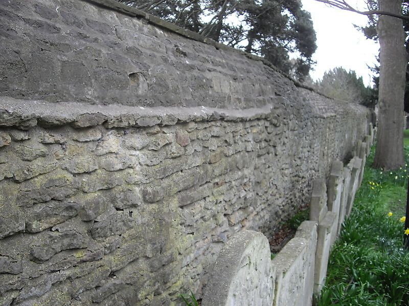
Hall to West of
Canonry House
TL 1998 NE 2/361A
II GV
2.
Rubble, recently breached for access to new buildings.
Deanery, Canory House & Wall, Table House, Infirmary, Nos 16 to 18 (consec),
No 20 & Wall form a group.
Listing NGR: TL1950298647
External links are from the relevant listing authority and, where applicable, Wikidata. Wikidata IDs may be related buildings as well as this specific building. If you want to add or update a link, you will need to do so by editing the Wikidata entry.


Other nearby listed buildings
