Approximate Location Map
Large Map »
Latitude: 50.713 / 50°42'46"N
Longitude: -2.438 / 2°26'16"W
OS Eastings: 369171
OS Northings: 90470
OS Grid: SY691904
Mapcode National: GBR PY.RMP3
Mapcode Global: FRA 57S6.805
Plus Code: 9C2VPH76+6R
Entry Name: 17-19, Trinity Street
Listing Date: 8 May 1975
Grade: II
Source: Historic England
Source ID: 1220727
English Heritage Legacy ID: 394429
ID on this website: 101220727
Location: Dorchester, Dorset, DT1
County: Dorset
Civil Parish: Dorchester
Built-Up Area: Dorchester
Traditional County: Dorset
Lieutenancy Area (Ceremonial County): Dorset
Church of England Parish: Dorchester and West Stafford
Church of England Diocese: Salisbury
Tagged with: Building
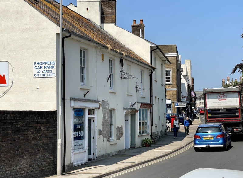
1. TRINITY STREET
5191
(West Side)
Nos 17 to 19 (consec)
SY 6990 7/300
II
2.
Early C19. Stucco. Pitched slate roof. 2 storeys. 3 ranges of sashes with
glazing bars. 1 blocked window. 3 flush-panel doors, with flat hoods on cut
brackets.
Listing NGR: SY6917190470
External links are from the relevant listing authority and, where applicable, Wikidata. Wikidata IDs may be related buildings as well as this specific building. If you want to add or update a link, you will need to do so by editing the Wikidata entry.


Other nearby listed buildings
