Approximate Location Map
Large Map »
Latitude: 51.2279 / 51°13'40"N
Longitude: 1.4042 / 1°24'15"E
OS Eastings: 637773
OS Northings: 153147
OS Grid: TR377531
Mapcode National: GBR X1R.V4V
Mapcode Global: VHMDG.9D6H
Plus Code: 9F336CH3+5M
Entry Name: The Albion Inn
Listing Date: 8 February 1974
Grade: II
Source: Historic England
Source ID: 1250724
English Heritage Legacy ID: 176989
Also known as: Albion
The Albion, Deal
ID on this website: 101250724
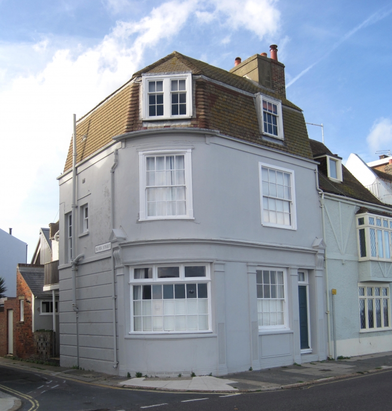
BEACH STREET
1.
1935
(West Side)
No l67
(The Albion Inn)
TR 1935 SE 2/32
II GV
2.
C18. 3 storeys stucco fronted. Renewed tiled mansarded roof. C19 pub front
with 5 pilasters. +
Nos 167 to 175 (odd) and No 179 form a group.
Listing NGR: TR3777353147
External links are from the relevant listing authority and, where applicable, Wikidata. Wikidata IDs may be related buildings as well as this specific building. If you want to add or update a link, you will need to do so by editing the Wikidata entry.


Other nearby listed buildings
