Approximate Location Map
Large Map »
Latitude: 54.4037 / 54°24'13"N
Longitude: -1.7396 / 1°44'22"W
OS Eastings: 416999
OS Northings: 500941
OS Grid: NZ169009
Mapcode National: GBR JK9J.55
Mapcode Global: WHC6D.7KVY
Plus Code: 9C6WC736+F4
Entry Name: 5, Newbiggin
Listing Date: 15 October 1973
Grade: II
Source: Historic England
Source ID: 1260840
English Heritage Legacy ID: 439292
ID on this website: 101260840
Location: Richmond, North Yorkshire, DL10
County: North Yorkshire
District: Richmondshire
Civil Parish: Richmond
Built-Up Area: Richmond
Traditional County: Yorkshire
Lieutenancy Area (Ceremonial County): North Yorkshire
Church of England Parish: Richmond with Holy Trinity with Hudswell
Church of England Diocese: Leeds
Tagged with: Building
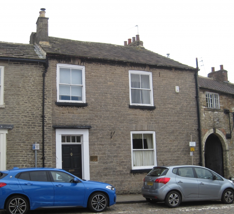
1. NEWBIGGIN
1549 (East Side)
No 5
NZ 1700 NW 1/257
II
2.
C18. Two storeys in coursed rubble. Slate roof. Two windows, no glazing
bars. Door of six panels with four-light rectangular fanlight. Basement
opening.
Listing NGR: NZ1699900941
External links are from the relevant listing authority and, where applicable, Wikidata. Wikidata IDs may be related buildings as well as this specific building. If you want to add or update a link, you will need to do so by editing the Wikidata entry.


Other nearby listed buildings
