Approximate Location Map
Large Map »
Latitude: 51.4828 / 51°28'58"N
Longitude: -0.355 / 0°21'18"W
OS Eastings: 514321
OS Northings: 177266
OS Grid: TQ143772
Mapcode National: GBR 5G.C4Z
Mapcode Global: VHFTD.SZPN
Plus Code: 9C3XFJMV+4X
Entry Name: 133, Jersey Road
Listing Date: 21 October 1982
Grade: II
Source: Historic England
Source ID: 1260849
English Heritage Legacy ID: 439328
ID on this website: 101260849
Location: Lampton, Hounslow, London, TW7
County: London
District: Hounslow
Electoral Ward/Division: Osterley and Spring Grove
Parish: Non Civil Parish
Built-Up Area: Hounslow
Traditional County: Middlesex
Lieutenancy Area (Ceremonial County): Greater London
Church of England Parish: St Mary Spring Grove
Church of England Diocese: London
Tagged with: Building
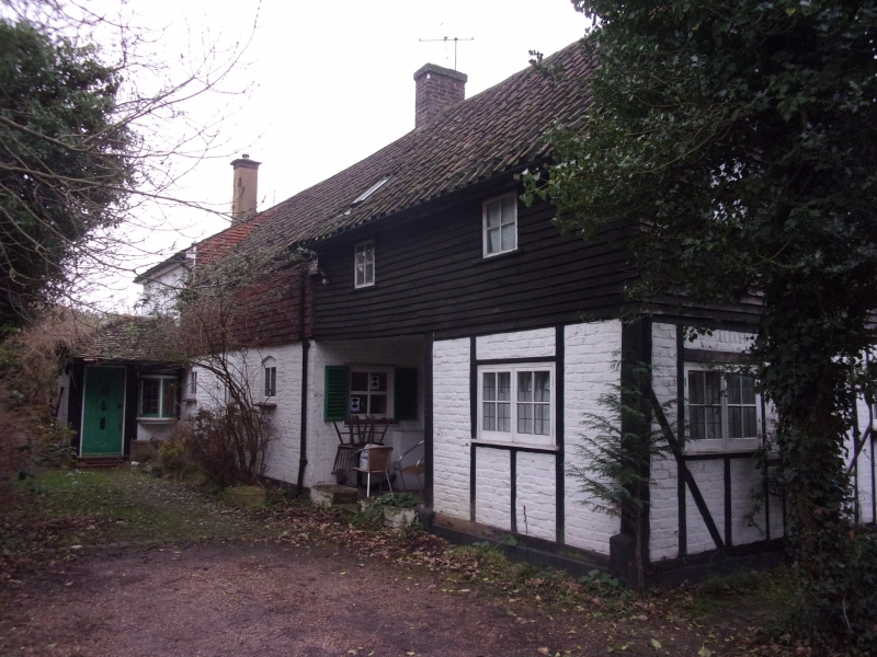
1. JERSEY ROAD
4419 No 133
TQ 1477 27/6 GV
II
2.
Possibly C17. Small, timber framed barn now converted into a house partly
boarded, partly clad in brick. Pantiled roof. Additions and considerable
alterations. Modern windows.
Listing NGR: TQ1432177266
External links are from the relevant listing authority and, where applicable, Wikidata. Wikidata IDs may be related buildings as well as this specific building. If you want to add or update a link, you will need to do so by editing the Wikidata entry.


Other nearby listed buildings
