Approximate Location Map
Large Map »
Latitude: 51.2678 / 51°16'3"N
Longitude: 0.3759 / 0°22'33"E
OS Eastings: 565842
OS Northings: 154748
OS Grid: TQ658547
Mapcode National: GBR NPP.KTL
Mapcode Global: VHJMB.GDKH
Plus Code: 9F32799G+48
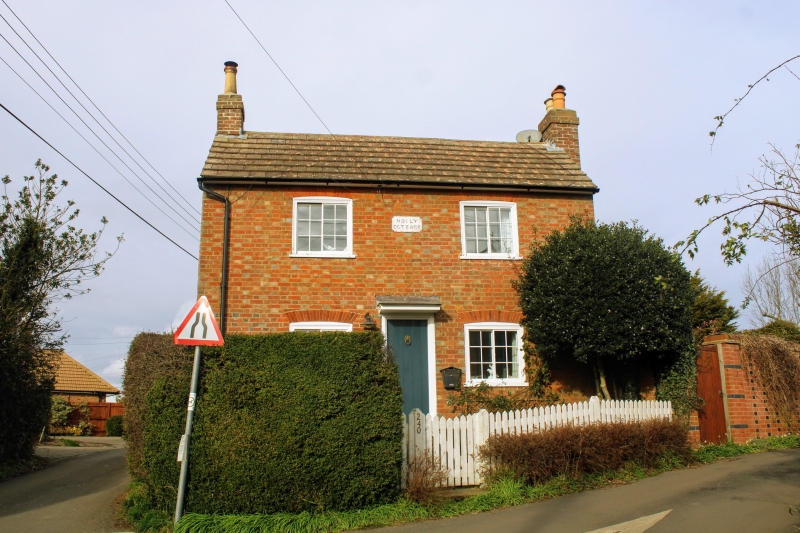
Entry Name: Holly Cottage
Listing Date: 19 April 1985
Grade: II
Source: Historic England
Source ID: 1363024
English Heritage Legacy ID: 178865
ID on this website: 101363024
Location: Herne Pound, Tonbridge and Malling, Kent, ME18
County: Kent
District: Tonbridge and Malling
Civil Parish: Mereworth
Traditional County: Kent
Lieutenancy Area (Ceremonial County): Kent
Church of England Parish: Mereworth St Lawrence
Church of England Diocese: Rochester
Tagged with: Cottage
TQ 65 SE MEREWORTH BUTCHER'S LANE
(east side)
2/1 Holly Cottage
-
- II
Mid C19 cottage. Red brick with grey headers. Moulded eaves cornice to tiled
valley roof, with end stacks to front block, stack at rear. Incised render
on west end. 2 storeys, 2 windows, casements in segment-headed surrounds.
Central boarded door with flat hood.
Listing NGR: TQ6589854688
External links are from the relevant listing authority and, where applicable, Wikidata. Wikidata IDs may be related buildings as well as this specific building. If you want to add or update a link, you will need to do so by editing the Wikidata entry.


Other nearby listed buildings
