Approximate Location Map
Large Map »
Latitude: 51.4094 / 51°24'33"N
Longitude: -3.488 / 3°29'16"W
OS Eastings: 296601
OS Northings: 168868
OS Grid: SS966688
Mapcode National: GBR HJ.QFCB
Mapcode Global: VH5HZ.HTCY
Plus Code: 9C3RCG56+QQ
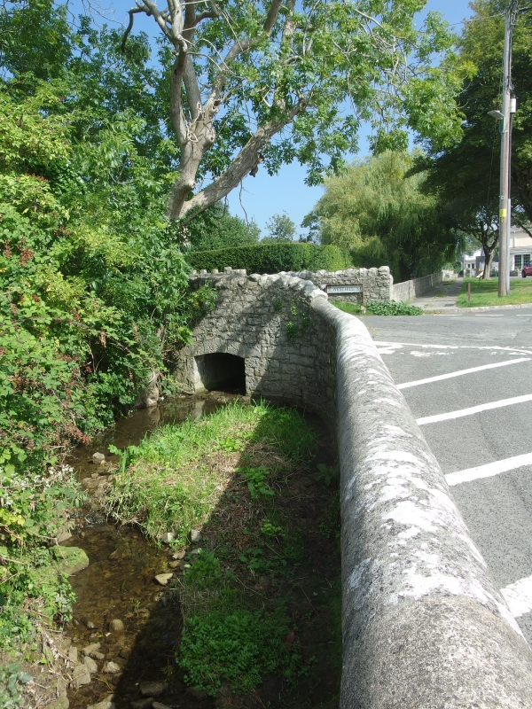
Entry Name: The Swine Bridge
Listing Date: 10 September 1982
Last Amended: 16 December 2004
Grade: II
Source: Cadw
Source ID: 13283
Building Class: Transport
ID on this website: 300013283
Location: About 180m north of the Church of St. Illtud and just to the south of Swimbridge Farmhouse.
County: Vale of Glamorgan
Town: Cowbridge / Y Bont-Faen
Community: Llantwit Major (Llanilltud Fawr)
Community: Llantwit Major
Built-Up Area: Llantwit Major
Traditional County: Glamorgan
Tagged with: Bridge Road bridge
C18 to C19.
The Swine Bridge over the Ogney Brook has a shallow segmental arch with stone voussoirs and parapet walls of stone rubble, the parapet wall on NE side common with SW garden wall to Swimbridge Farm.
Included as a small historic bridge in an exceptional context.
External links are from the relevant listing authority and, where applicable, Wikidata. Wikidata IDs may be related buildings as well as this specific building. If you want to add or update a link, you will need to do so by editing the Wikidata entry.


Other nearby listed buildings
