Approximate Location Map
Large Map »
Latitude: 51.5851 / 51°35'6"N
Longitude: -2.7861 / 2°47'9"W
OS Eastings: 345633
OS Northings: 187654
OS Grid: ST456876
Mapcode National: GBR JG.C9XB
Mapcode Global: VH7BH.NFG6
Plus Code: 9C3VH6P7+2H
Entry Name: Stables at Manor House Farm
Listing Date: 22 February 1995
Last Amended: 22 February 1995
Grade: II
Source: Cadw
Source ID: 15936
Building Class: Domestic
ID on this website: 300015936
Location: Situated facing the farmhouse, just north of St Mary's Church and churchyard.
County: Monmouthshire
Community: Rogiet
Community: Rogiet
Built-Up Area: Rogiet
Traditional County: Monmouthshire
Tagged with: Stable
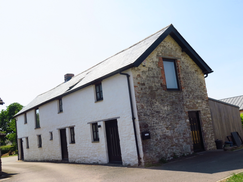
Modest C19 4-bay former stable block with hayloft above of limewashed rubble lower courses of earlier date and brick above under Welsh slate roof with brick ridge stack and pitching door in gable. Reflected pair of stable doors and windows to right.
Listed for group value with Manor House FarmHouse and Barn and St Mary's Church.
External links are from the relevant listing authority and, where applicable, Wikidata. Wikidata IDs may be related buildings as well as this specific building. If you want to add or update a link, you will need to do so by editing the Wikidata entry.


Other nearby listed buildings
