Approximate Location Map
Large Map »
Latitude: 53.0878 / 53°5'16"N
Longitude: -3.2925 / 3°17'32"W
OS Eastings: 313533
OS Northings: 355292
OS Grid: SJ135552
Mapcode National: GBR 6S.9JQH
Mapcode Global: WH77H.DND5
Plus Code: 9C5R3PQ5+42
Entry Name: Milestone
Listing Date: 19 May 2001
Last Amended: 19 May 2001
Grade: II
Source: Cadw
Source ID: 25218
Building Class: Transport
ID on this website: 300025218
Location: Beside A525 in Llanfair Dyffryn Clwyd, opposite entrance to Y Wynallt
County: Denbighshire
Community: Llanfair Dyffryn Clwyd
Community: Llanfair Dyffryn Clwyd
Traditional County: Denbighshire
Tagged with: Milestone
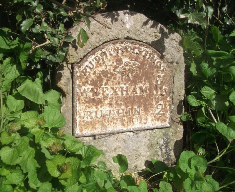
Milestone of former Wrexham to Ruthin Turnpike Road.
A single block of the local limestone, about 400mm wide by about 200mm deep, and standing about 600mm high, curved at the top and with a flat face. A cast-iron plate with a rounded top is affixed to the stone and carries the wording "Ruthin District / Wrexham 16 / Ruthin 2."
A mid-C19 milestone in good condition.
External links are from the relevant listing authority and, where applicable, Wikidata. Wikidata IDs may be related buildings as well as this specific building. If you want to add or update a link, you will need to do so by editing the Wikidata entry.


Other nearby listed buildings
