Approximate Location Map
Large Map »
Latitude: 51.7206 / 51°43'14"N
Longitude: -3.2427 / 3°14'33"W
OS Eastings: 314254
OS Northings: 203164
OS Grid: SO142031
Mapcode National: GBR HV.2WJX
Mapcode Global: VH6D6.R02S
Plus Code: 9C3RPQC4+7W
Entry Name: War Memorial
Listing Date: 22 June 2001
Last Amended: 22 June 2001
Grade: II
Source: Cadw
Source ID: 25496
Building Class: Commemorative
ID on this website: 300025496
Location: Right in the centre of New Tredegar town, set on steps in a walled enclosure; a dominant position, backing onto the church of St Dingat and the adjacent Hall and opposite the Tredegar Arms Hotel.
County: Caerphilly
Community: New Tredegar (Tredegar Newydd)
Community: New Tredegar
Built-Up Area: New Tredegar
Traditional County: Monmouthshire
Tagged with: War memorial
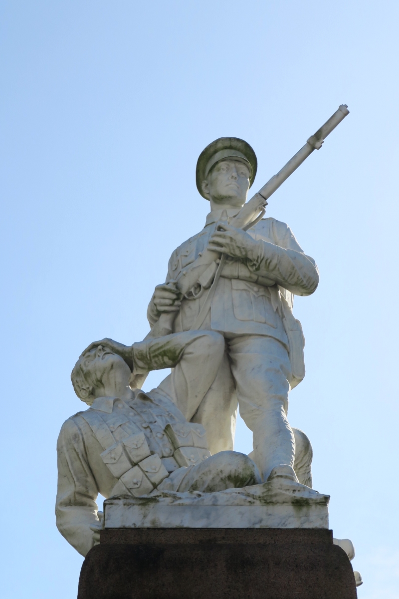
First World War 1914-18 memorial with names added after Second World War, 1939-45. Attributable to L F Roslyn. Similar to one at Maesteg.
War Memorial. A red granite pedestal with white marble figures. Pedestal consists of 3 shallow rock-faced steps supporting a polished pier with battered plinth, inscription panel on front and names on 3 sides of the main pier and plinth sections, with tooled plain deep frieze and coping; the sections are separated by rock-faced bands. Two life-size figures: one a standing soldier with gun at the ready, the other hatless, collapsed and clasping his head with one hand.
Listed as a more than usually elaborate Valleys' war memorial.
External links are from the relevant listing authority and, where applicable, Wikidata. Wikidata IDs may be related buildings as well as this specific building. If you want to add or update a link, you will need to do so by editing the Wikidata entry.


Other nearby listed buildings
