Approximate Location Map
Large Map »
Latitude: 51.7261 / 51°43'33"N
Longitude: -3.2396 / 3°14'22"W
OS Eastings: 314476
OS Northings: 203766
OS Grid: SO144037
Mapcode National: GBR HV.2HTM
Mapcode Global: VH6D0.SWP5
Plus Code: 9C3RPQG6+C5
Entry Name: Barn range at Cefnrhychdir
Listing Date: 22 June 2001
Last Amended: 22 June 2001
Grade: II
Source: Cadw
Source ID: 25499
Building Class: Agriculture and Subsistence
ID on this website: 300025499
Location: Long range forming the upper side of the farmyard; the farm is on the boundary of the urban development of Phillip's Town, the NE part of New Tredegar.
County: Caerphilly
Community: New Tredegar (Tredegar Newydd)
Community: New Tredegar
Locality: Phillip's Town
Built-Up Area: New Tredegar
Traditional County: Monmouthshire
Tagged with: Barn
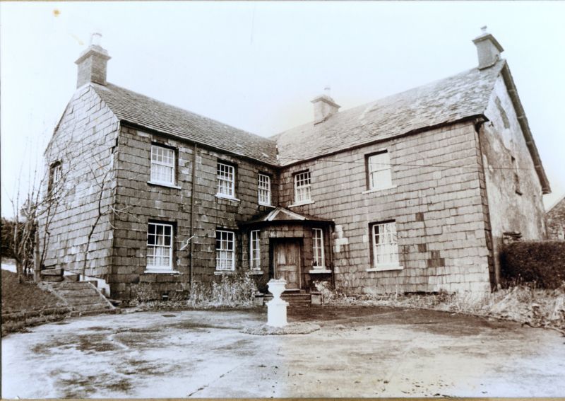
The house, modernised and excluded from the listing, reputedly has a C16 origin and was remodelled in the early C19. Tithe Map of 1842 shows the farmyard layout almost exactly as at present, and the first edition OS map of 1878 shows the front lean-to. The tithe apportionment of 1842 identifies the owner as Sir Charles Morgan (of Tredegar) and the occupier as Matthew Fothergill - the title of the farm given then as Cefnuchdir. The Fothergills were industrialists and reputedly much visited by their landlord Lord Tredegar, who owned land on this E side of the Rhymney River.
Long tall barn range of rubble partly limewashed with corrugated roof forming the W side of the farmyard. A clear masonry break occurs between the main range to right and the end bay left which has a slightly lower ridge; attached at end left is a 2-storey lean-to with a tiny hip to the roof which retains slates; further small lean-to at front left. A corrugated pentice extends across almost the whole frontage providing shelter to 3 of the 5 doorways. Small rectangular windows flank the two centre left doorways. Above are 3 small ventilation slits to the main range and a cambered-arched pitching door with stepped buttress beneath. The left bay has rectangular windows one above the other, with a further upper window with timber lintel in the lean-to at end left.
Included, notwithstanding replaced roof covering, for group value with the L-shaped farm ranges and to complete the farmyard group.
External links are from the relevant listing authority and, where applicable, Wikidata. Wikidata IDs may be related buildings as well as this specific building. If you want to add or update a link, you will need to do so by editing the Wikidata entry.


Other nearby listed buildings
