Approximate Location Map
Large Map »
Latitude: 52.9222 / 52°55'19"N
Longitude: -3.4378 / 3°26'15"W
OS Eastings: 303434
OS Northings: 337051
OS Grid: SJ034370
Mapcode National: GBR 6L.MZB0
Mapcode Global: WH786.5T75
Plus Code: 9C4RWHC6+VV
Entry Name: Sun-dial in Churchyard
Listing Date: 3 October 2003
Last Amended: 3 October 2003
Grade: II
Source: Cadw
Source ID: 81892
Building Class: Religious, Ritual and Funerary
ID on this website: 300081892
Location: Located in the churchyard to the SW of the Church of St Trillo.
County: Denbighshire
Community: Llandrillo
Community: Llandrillo
Traditional County: Merionethshire
Tagged with: Architectural structure
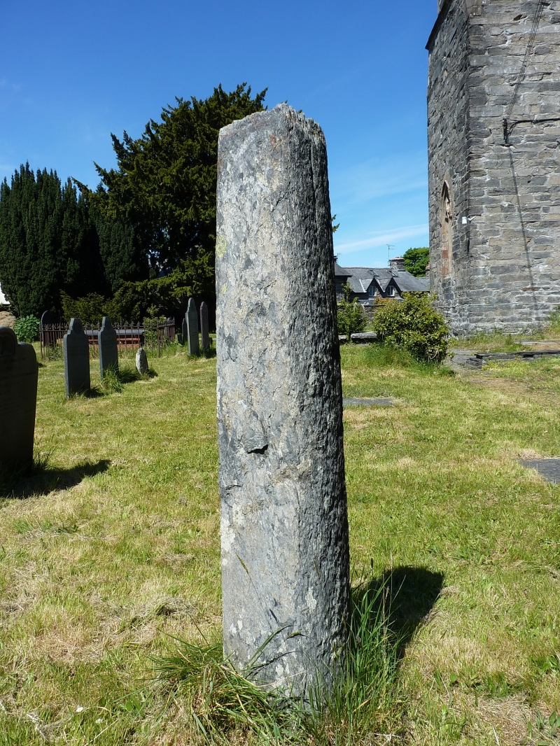
C18 sundial. The shaft could be part of a re-used preaching cross.
Tall stone shaft with rounded corners, surrounded by iron band near top. It is surmounted by a brass sun-dial, the gnomon missing.
Listed for its historical interest and for group value with the Church of St Trillo.
External links are from the relevant listing authority and, where applicable, Wikidata. Wikidata IDs may be related buildings as well as this specific building. If you want to add or update a link, you will need to do so by editing the Wikidata entry.


Other nearby listed buildings
