Approximate Location Map
Large Map »
Latitude: 52.5711 / 52°34'15"N
Longitude: -0.2391 / 0°14'20"W
OS Eastings: 519435
OS Northings: 298484
OS Grid: TL194984
Mapcode National: GBR HZQ.SF0
Mapcode Global: WHHNK.9MCT
Plus Code: 9C4XHQC6+C8
Entry Name: Former Barns and Stabling to South of Number 20
Listing Date: 7 February 1952
Grade: I
Source: Historic England
Source ID: 1126930
English Heritage Legacy ID: 49652
ID on this website: 101126930
Location: Peterborough, Cambridgeshire, PE1
County: City of Peterborough
Electoral Ward/Division: Central
Parish: Non Civil Parish
Built-Up Area: Peterborough
Traditional County: Northamptonshire
Lieutenancy Area (Ceremonial County): Cambridgeshire
Tagged with: Barn
PETERBOROUGH
1.
1500
PRECINCTS
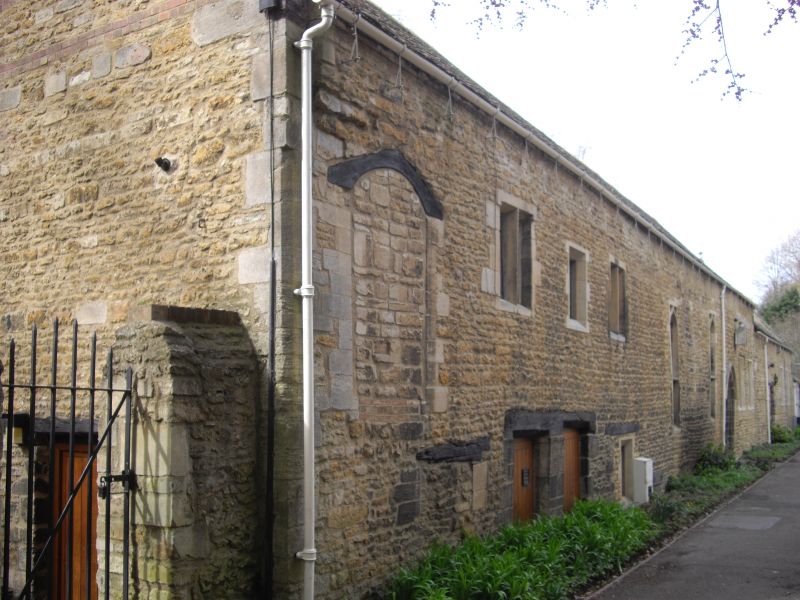
Former barns and stabling barns and stabling
to south of No 20
TL 1998 SW 3/17 7.2.52.
I GV
2.
Dates in part from C18, but now used for storage and garages. Rubble.
Irregular fenestration, some modern. Mullions and tail transomed 1-light
windows of C14. Remains of gateway to west. 2 storey.
Listing NGR: TL1943598484
External links are from the relevant listing authority and, where applicable, Wikidata. Wikidata IDs may be related buildings as well as this specific building. If you want to add or update a link, you will need to do so by editing the Wikidata entry.


Other nearby listed buildings
