Latitude: 51.3237 / 51°19'25"N
Longitude: -2.2038 / 2°12'13"W
OS Eastings: 385893
OS Northings: 158310
OS Grid: ST858583
Mapcode National: GBR 1SM.TYC
Mapcode Global: VH96W.RZ9M
Plus Code: 9C3V8QFW+FF
Entry Name: Gateway to Church of St Thomas's
Listing Date: 26 November 1976
Grade: II
Source: Historic England
Source ID: 1021644
English Heritage Legacy ID: 314128
ID on this website: 101021644
Location: St Thomas's Church, Trowbridge, Wiltshire, BA14
County: Wiltshire
Civil Parish: Trowbridge
Built-Up Area: Trowbridge
Traditional County: Wiltshire
Lieutenancy Area (Ceremonial County): Wiltshire
Church of England Parish: Trowbridge St Thomas
Church of England Diocese: Salisbury
Tagged with: Gate
ST THOMAS'S ROAD 1. 5411 Gateway to Church of St Thomas's ST 8558 5/350A II
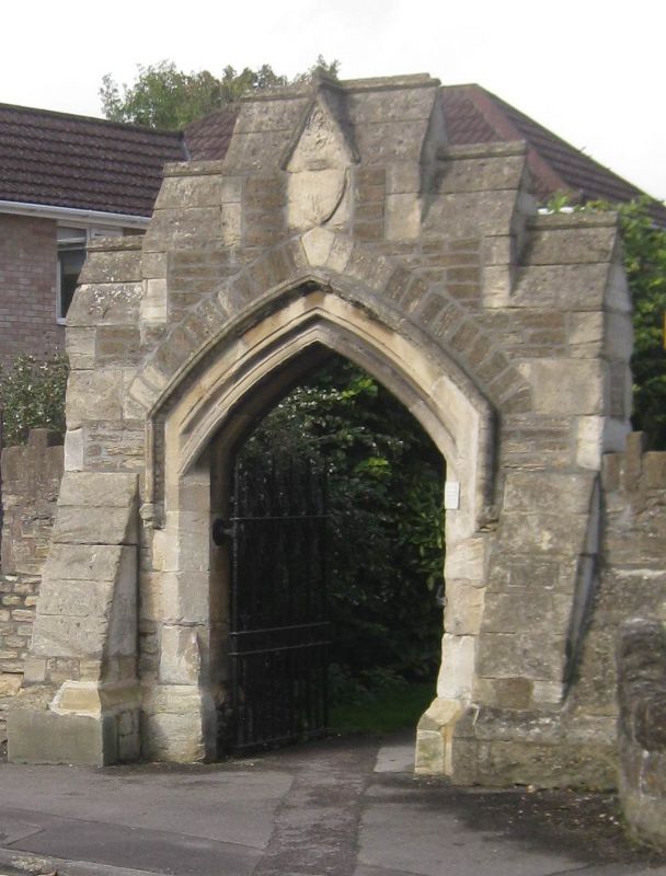
2. Circa 1868. Probably designed and built by William Smith, the local architect. Large stone gateway with 3 steps to ridge over pointed archway with mouldings dying at impost and beaded and stilted label. Gablet over obscured shield. Weathered buttresses at sides with ground level gablets. Recess of gateway has carved panel depicting the Good Shepherd over gates. Cast iron gates with the usual Trowbridge wrought and plate iron ornament in the form of fern-leafs.
Listing NGR: ST8589358310
External links are from the relevant listing authority and, where applicable, Wikidata. Wikidata IDs may be related buildings as well as this specific building. If you want to add or update a link, you will need to do so by editing the Wikidata entry.


Other nearby listed buildings