Latitude: 51.4922 / 51°29'32"N
Longitude: -2.2286 / 2°13'43"W
OS Eastings: 384222
OS Northings: 177058
OS Grid: ST842770
Mapcode National: GBR 1QN.FBZ
Mapcode Global: VH963.BR5D
Plus Code: 9C3VFQRC+VG
Entry Name: 2 and 3, Water Lane
Listing Date: 20 December 1960
Last Amended: 9 December 1985
Grade: II
Source: Historic England
Source ID: 1022888
English Heritage Legacy ID: 317272
ID on this website: 101022888
Location: Castle Combe, Wiltshire, SN14
County: Wiltshire
Civil Parish: Castle Combe
Traditional County: Wiltshire
Lieutenancy Area (Ceremonial County): Wiltshire
Church of England Parish: Castle Combe
Church of England Diocese: Bristol
Tagged with: Building
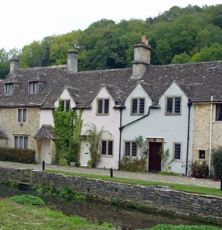
CASTLE COMBE WATER LANE
ST 8477
6/180 Nos. 2 and 3
(formerly listed as Nos. 2 and 3
20.12.60 Brookside)
GV II
Pair of cottages, later C18, rough rendered stone with stone tiled
roof. Large ridge stack between houses. One-and-a-half storeys.
4 dormer gables with cyma-moulded flush mullion 2-light windows to
first floor. Ground floor, to left, door in gabled porch with
stone slab sides, now part of No. 1 (q.v.), then symmetrical
arrangement of single light, door in flush stone surround with
hoodmould, two 2-light cyma-moulded flush mullion windows, door
with hoodmould and single light.
Listing NGR: ST8422177064
External links are from the relevant listing authority and, where applicable, Wikidata. Wikidata IDs may be related buildings as well as this specific building. If you want to add or update a link, you will need to do so by editing the Wikidata entry.


Other nearby listed buildings