Latitude: 51.6426 / 51°38'33"N
Longitude: -1.9331 / 1°55'59"W
OS Eastings: 404726
OS Northings: 193752
OS Grid: SU047937
Mapcode National: GBR 3RR.XSB
Mapcode Global: VHB2Y.FZX6
Plus Code: 9C3WJ3V8+2Q
Entry Name: Ashton House, River Wall and Bridge
Listing Date: 17 January 1955
Last Amended: 17 April 1986
Grade: II
Source: Historic England
Source ID: 1023069
English Heritage Legacy ID: 317700
ID on this website: 101023069
SU 09 SW ASHTON KEYNES HIGH ROAD (west side)
11/51 Ashton House, river wall and bridge (formerly listed as Ashton House) 17.1.55 GV II
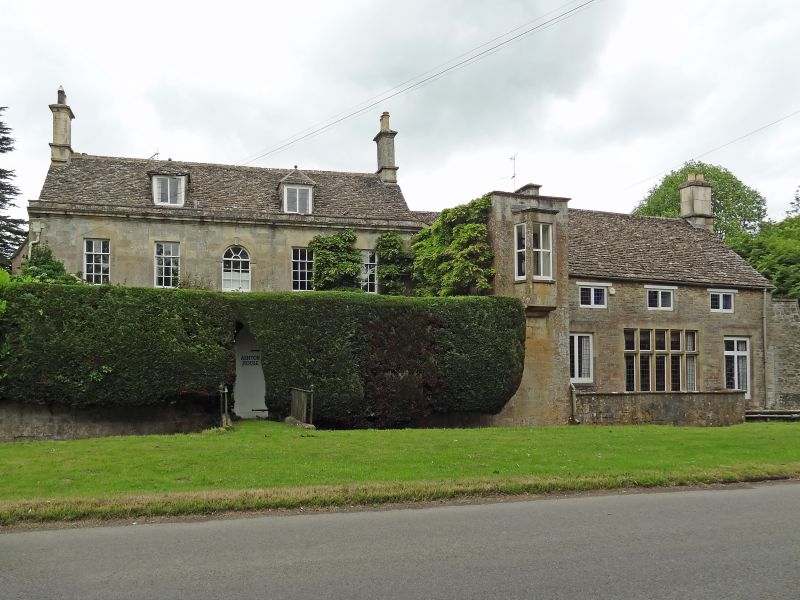
House. Mid-late C18 and C19. Limestone ashlar, stone slate roof. Two-storey and attics. Five window bays with 2 bay return on north, and further block overlooking river. Main block has 6-pane sashes to ground floor, continuous dripmould and keyed surrounds to openings. Twelve-pane sashes to first floor but centre window with round head and keyed surround. Moulded parapet. Two hipped dormers with leaded casements and knob finials. Gable stacks. End return has blind windows and canted oriel over river in narrow end. Block beyond return has 5-light mullioned and transomed window and leaded casements with timber lintels to first floor. Right gable stack. To rear of main block, a parallel block of early/mid C19 with 12-pane sashes and at left end a cross wing of 2 storeys and single storey link across end of main block forming entrance. This building has stone mullioned and transomed windows with label mouldings. At front of building, a limestone ashlar river wall to Thames, with 1 skewed arch bridge on axis, and riverside terrace in front of north block. A picturesque group.
Listing NGR: SU0472993749
External links are from the relevant listing authority and, where applicable, Wikidata. Wikidata IDs may be related buildings as well as this specific building. If you want to add or update a link, you will need to do so by editing the Wikidata entry.


Other nearby listed buildings