Approximate Location Map
Large Map »
Latitude: 51.6376 / 51°38'15"N
Longitude: -1.8581 / 1°51'29"W
OS Eastings: 409917
OS Northings: 193212
OS Grid: SU099932
Mapcode National: GBR 3S1.C1L
Mapcode Global: VHB35.R32F
Plus Code: 9C3WJ4QR+3Q
Entry Name: Orthostatic Wall to Number 18
Listing Date: 11 November 1976
Grade: II
Source: Historic England
Source ID: 1023094
English Heritage Legacy ID: 317764
ID on this website: 101023094
Location: Cricklade, Wiltshire, SN6
County: Wiltshire
Civil Parish: Cricklade
Built-Up Area: Cricklade
Traditional County: Wiltshire
Lieutenancy Area (Ceremonial County): Wiltshire
Church of England Parish: Cricklade
Church of England Diocese: Bristol
Tagged with: Wall
SU 09 SE CRICKLADE THE FORTY
(north side)
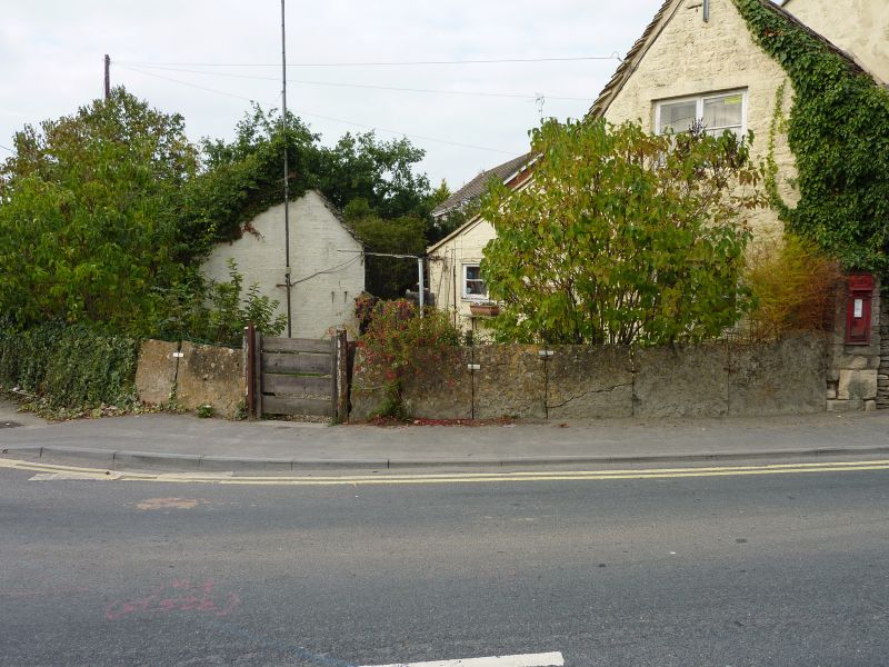
12/115 Orthostatic wall to No. 18
11.11.76
II
Orthostatic limestone wall, early-mid C19, defining front garden
wall of No 18 against footpath.
Listing NGR: SU0991793212
External links are from the relevant listing authority and, where applicable, Wikidata. Wikidata IDs may be related buildings as well as this specific building. If you want to add or update a link, you will need to do so by editing the Wikidata entry.


Other nearby listed buildings
