Latitude: 51.6607 / 51°39'38"N
Longitude: -1.8667 / 1°52'0"W
OS Eastings: 409318
OS Northings: 195778
OS Grid: SU093957
Mapcode National: GBR 3RN.WBN
Mapcode Global: VHB2Z.LJJ7
Plus Code: 9C3WM46M+78
Entry Name: Cook Monument in Churchyard, 10 Metres South West of Tower, Church of St John
Listing Date: 17 April 1986
Grade: II
Source: Historic England
Source ID: 1023132
English Heritage Legacy ID: 317852
ID on this website: 101023132
Location: St John Baptist's Church, Latton, Wiltshire, SN6
County: Wiltshire
Civil Parish: Latton
Built-Up Area: Latton
Traditional County: Wiltshire
Lieutenancy Area (Ceremonial County): Wiltshire
Church of England Parish: Latton
Church of England Diocese: Bristol
Tagged with: Monument
SU 09 NE LATTON CROFT LANE
(north side)
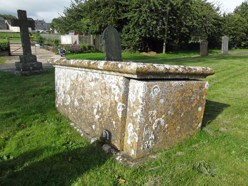
2/202 Cook monument in churchyard,
10m south-west of tower, Church
of St. John
II
Chest tomb. 1737. Limestone. Moulded table and chamfered base.
Inscribed top and side panels to a member of the COOK family.
Listing NGR: SU0931895778
External links are from the relevant listing authority and, where applicable, Wikidata. Wikidata IDs may be related buildings as well as this specific building. If you want to add or update a link, you will need to do so by editing the Wikidata entry.


Other nearby listed buildings