Latitude: 51.6545 / 51°39'16"N
Longitude: -1.8646 / 1°51'52"W
OS Eastings: 409461
OS Northings: 195092
OS Grid: SU094950
Mapcode National: GBR 3RV.9D6
Mapcode Global: VHB2Z.MNLZ
Plus Code: 9C3WM43P+R5
Entry Name: Court Farmhouse
Listing Date: 17 April 1986
Grade: II
Source: Historic England
Source ID: 1023134
English Heritage Legacy ID: 317857
ID on this website: 101023134
Location: Latton, Wiltshire, SN6
County: Wiltshire
Civil Parish: Latton
Traditional County: Wiltshire
Lieutenancy Area (Ceremonial County): Wiltshire
Church of England Parish: Latton
Church of England Diocese: Bristol
Tagged with: Farmhouse
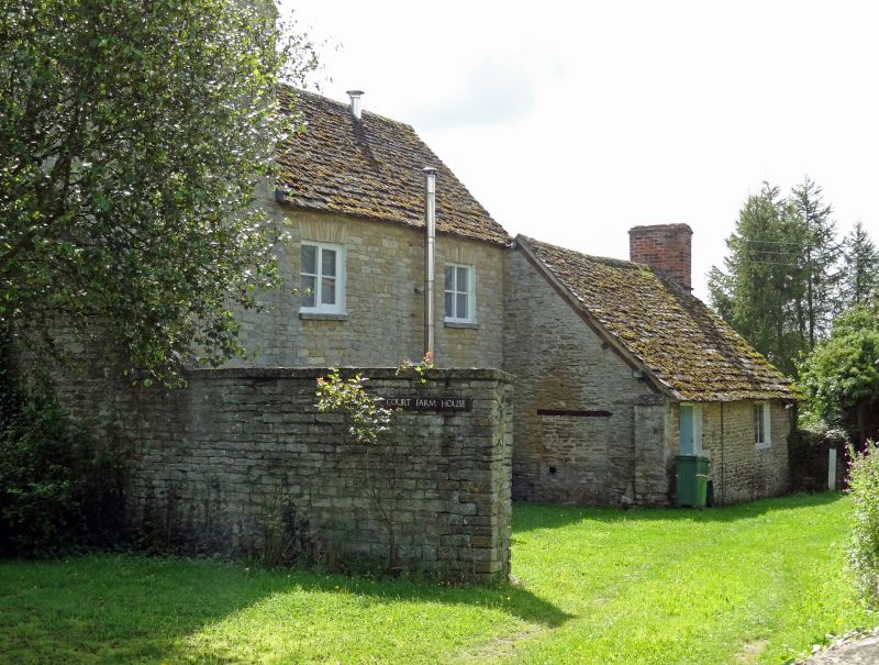
SU 09 NE LATTON ERMIN STREET
(south-west side)
2/207 Court Farmhouse
II
Farmhouse. c1840. Limestone rubble with ashlar quoins. Stone
slate roof. Three storeys. 3 x 1 bays. Central entrance in
gabled stone porch. Two and 3-light casements with chamfered
mullions and segmental heads. Gable stacks. Two rear wings each
of 2 bays 2 storeys. Attached front wall rakes up to second floor
level.
Listing NGR: SU0946195092
External links are from the relevant listing authority and, where applicable, Wikidata. Wikidata IDs may be related buildings as well as this specific building. If you want to add or update a link, you will need to do so by editing the Wikidata entry.


Other nearby listed buildings