Approximate Location Map
Large Map »
Latitude: 51.5878 / 51°35'16"N
Longitude: -1.8684 / 1°52'6"W
OS Eastings: 409216
OS Northings: 187666
OS Grid: SU092876
Mapcode National: GBR 3SM.GGB
Mapcode Global: VHB3C.KCM4
Plus Code: 9C3WH4QJ+4M
Entry Name: The Maltster Public House
Listing Date: 17 April 1986
Grade: II
Source: Historic England
Source ID: 1023176
English Heritage Legacy ID: 317960
ID on this website: 101023176
Location: Purton, Wiltshire, SN5
County: Wiltshire
Civil Parish: Purton
Built-Up Area: Purton
Traditional County: Wiltshire
Lieutenancy Area (Ceremonial County): Wiltshire
Church of England Parish: Purton
Church of England Diocese: Bristol
Tagged with: Pub
SU 08 NE
8/313
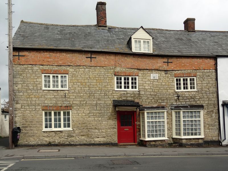
PURTON
HIGH STREET
(north side)
No. 7 The Maltster P.H.
II
Inn, end of row. 1673, altered in C20. Limestone rubble. Slate
roof. 2 storeys, 3 bays. Central half-glazed door and canopy.
C20 3-light paned windows with brick flat lintels. Two small paned
bays to right of door. Elevation raised in early C20 brick to
provide attic accommodation, and 1 gabled dormer. Stack to left of
through passage. C19 limestone wings to rear and lean-to.
Listing NGR: SU0921687666
External links are from the relevant listing authority and, where applicable, Wikidata. Wikidata IDs may be related buildings as well as this specific building. If you want to add or update a link, you will need to do so by editing the Wikidata entry.


Other nearby listed buildings
