Approximate Location Map
Large Map »
Latitude: 51.5531 / 51°33'11"N
Longitude: -1.7081 / 1°42'29"W
OS Eastings: 420333
OS Northings: 183837
OS Grid: SU203838
Mapcode National: GBR 4VK.DZP
Mapcode Global: VHC13.B7V8
Plus Code: 9C3WH73R+6Q
Entry Name: Wrightsbridge House Farmhouse and Coachhouse to East
Listing Date: 20 September 1979
Grade: II
Source: Historic England
Source ID: 1023427
English Heritage Legacy ID: 318588
ID on this website: 101023427
Location: Wanborough, Swindon, Wiltshire, SN4
County: Swindon
Civil Parish: Wanborough
Traditional County: Wiltshire
Lieutenancy Area (Ceremonial County): Wiltshire
Church of England Parish: Lyddington and Wanborough
Church of England Diocese: Bristol
Tagged with: Farmhouse
1.
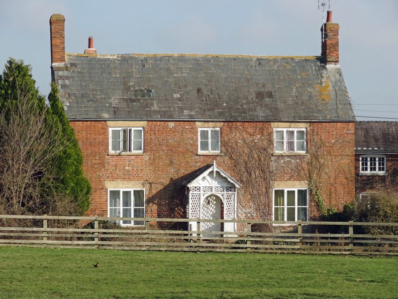
5410 WANBOROUGH WANBOROUGH MARSH
Wrightsbridge House
Farmhouse and
Coachhouse to east
SU 2083 24/502
II
2.
Dated W.S. Two storeys chalk rubble with red brick and blue headers front.
1831
Slate roof with gable end brick chimneys. Casement windows in 3 bays, outer
3 light. Ashlar lintels. Central gabled lattice porch.
To rear is a contemporary red and blue brick coachhouse with slate roof.
Two storeys, central segmental headed doors with flanking 3 light casements
and outer doors.
Listing NGR: SU2033383837
External links are from the relevant listing authority and, where applicable, Wikidata. Wikidata IDs may be related buildings as well as this specific building. If you want to add or update a link, you will need to do so by editing the Wikidata entry.


Other nearby listed buildings
