Approximate Location Map
Large Map »
Latitude: 51.5624 / 51°33'44"N
Longitude: -1.8536 / 1°51'13"W
OS Eastings: 410242
OS Northings: 184842
OS Grid: SU102848
Mapcode National: GBR 3SV.S7P
Mapcode Global: VHB3C.TZFN
Plus Code: 9C3WH46W+WG
Entry Name: Walled Garden North West of Lydiard Park
Listing Date: 23 April 1986
Grade: II
Source: Historic England
Source ID: 1023478
English Heritage Legacy ID: 318705
ID on this website: 101023478
Location: Lydiard Country Park, Middleleaze, Swindon, Wiltshire, SN5
County: Swindon
Electoral Ward/Division: Lydiard and Freshbrook
Parish: West Swindon
Built-Up Area: Swindon
Traditional County: Wiltshire
Lieutenancy Area (Ceremonial County): Wiltshire
Church of England Parish: West Swindon and the Lydiards
Church of England Diocese: Bristol
Tagged with: Walled garden
CHURCH LANE,
SU 18 SW SWINDON
West Swindon
3/45 Walled Garden north-west of
Lydiard park
II
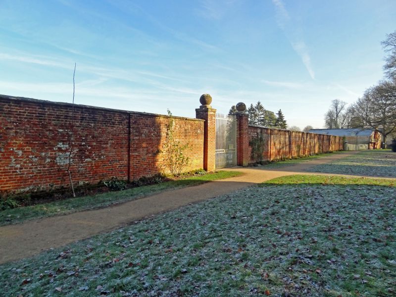
Walled kitchen garden north-west of mansion house (q.v.). Cl8.13md-
a-half inch brickwork garden wall bond. Rhomboid plan. Stone
copings, some recent replacement in concrete. Gate piers with
stone ball finials on south-west face recently rebuilt.
Listing NGR: SU1024284842
External links are from the relevant listing authority and, where applicable, Wikidata. Wikidata IDs may be related buildings as well as this specific building. If you want to add or update a link, you will need to do so by editing the Wikidata entry.


Other nearby listed buildings
