Latitude: 51.5519 / 51°33'6"N
Longitude: -1.7739 / 1°46'25"W
OS Eastings: 415775
OS Northings: 183690
OS Grid: SU157836
Mapcode National: GBR YSG.C3
Mapcode Global: VHB3M.68L5
Plus Code: 9C3WH62G+QF
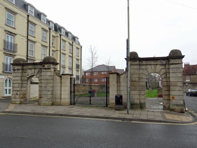
Entry Name: Gate Piers to the Lawns (Demolished)
Listing Date: 23 April 1986
Grade: II
Source: Historic England
Source ID: 1023500
English Heritage Legacy ID: 318763
ID on this website: 101023500
Location: Old Town, Swindon, Wiltshire, SN1
County: Swindon
Electoral Ward/Division: Old Town
Parish: South Swindon
Built-Up Area: Swindon
Traditional County: Wiltshire
Lieutenancy Area (Ceremonial County): Wiltshire
Church of England Parish: Swindon Christ Church
Church of England Diocese: Bristol
Tagged with: Gatepost
HIGH STREET SU 1583 NE SWINDON (east side) 8/102 Gate piers to The Lawns (demolished) II
Gate piers, early C19. Ashlar limestone. Two pairs of rusticated piers with simple entablature and cushion terminals, pierced by pedestrian gate openings, and separated by a wide carriageway. Former lodges removed.
Listing NGR: SU1577583690
External links are from the relevant listing authority and, where applicable, Wikidata. Wikidata IDs may be related buildings as well as this specific building. If you want to add or update a link, you will need to do so by editing the Wikidata entry.


Other nearby listed buildings