Latitude: 51.5498 / 51°32'59"N
Longitude: -1.7768 / 1°46'36"W
OS Eastings: 415570
OS Northings: 183459
OS Grid: SU155834
Mapcode National: GBR YRY.B0
Mapcode Global: VHB3M.590R
Plus Code: 9C3WG6XF+W7
Entry Name: The Royal Oak
Listing Date: 23 April 1986
Grade: II
Source: Historic England
Source ID: 1023508
English Heritage Legacy ID: 318787
ID on this website: 101023508
Location: Old Town, Swindon, Wiltshire, SN1
County: Swindon
Electoral Ward/Division: Old Town
Parish: South Swindon
Built-Up Area: Swindon
Traditional County: Wiltshire
Lieutenancy Area (Ceremonial County): Wiltshire
Church of England Parish: Swindon Christ Church
Church of England Diocese: Bristol
Tagged with: Pub
This list entry was subject to a Minor Amendment on 27 January 2025 to update the name and address and reformat the text to current standards
SU 1583 SE
10/125
SWINDON
NEWPORT STREET (south side)
DEVIZES ROAD
No 24 (The Royal Oak)
(Formerly listed as NEWPORT STREET (south side) No. 35 (Royal Oak P.H.) with 24 Devizes Road)
II
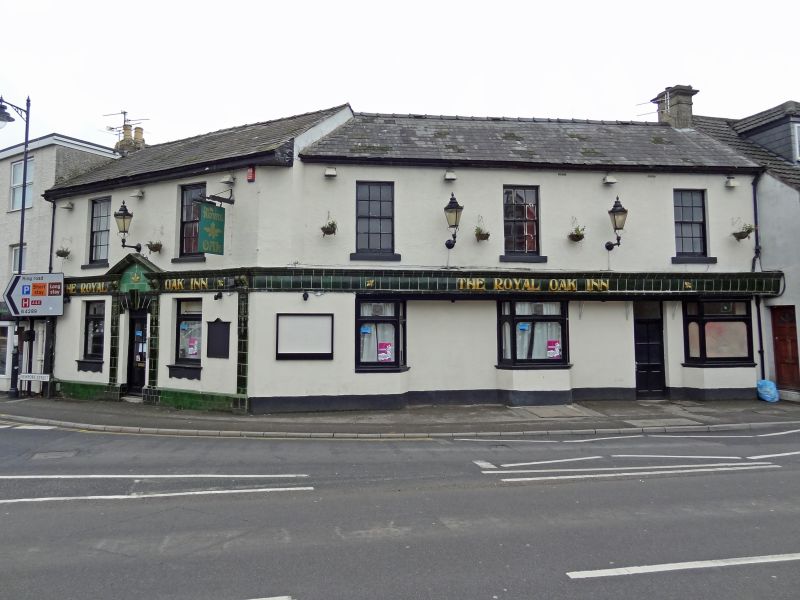
Public house. Early C19. Roughcast brickwork, slate roof. Two storey, two bays to Newport Street and three-bay return in Devizes Road. Central entrance on corner. Ground floor c1900 green glazed ceramic tile plinth, pilasters and pedimented doorcase with fascia and name. Windows with etched glass and green tiled aprons. Upper floor 12-pane sashes. Elevation to Devizes Road, glazed fascia continues over two canted bays and two entrances, one blocked. Three 12-pane sashes to first floor.
Listing NGR: SU1557083459
External links are from the relevant listing authority and, where applicable, Wikidata. Wikidata IDs may be related buildings as well as this specific building. If you want to add or update a link, you will need to do so by editing the Wikidata entry.


Other nearby listed buildings