Latitude: 52.0425 / 52°2'32"N
Longitude: -1.6779 / 1°40'40"W
OS Eastings: 422190
OS Northings: 238280
OS Grid: SP221382
Mapcode National: GBR 5PX.W22
Mapcode Global: VHBYL.VXVM
Plus Code: 9C4W28RC+XV
Entry Name: Town Farmhouse
Listing Date: 13 November 1967
Grade: II
Source: Historic England
Source ID: 1024084
English Heritage Legacy ID: 306534
ID on this website: 101024084
Location: Stretton-on-Fosse, Stratford-on-Avon, Warwickshire, GL56
County: Warwickshire
District: Stratford-on-Avon
Civil Parish: Stretton-on-Fosse
Built-Up Area: Stretton-on-Fosse
Traditional County: Warwickshire
Lieutenancy Area (Ceremonial County): Warwickshire
Church of England Parish: Stretton-on-Fosse St Peter
Church of England Diocese: Coventry
Tagged with: Farmhouse
STRETTON ON FOSSE SP2238 15/168 Town Farmhouse 13/11/67
GV II
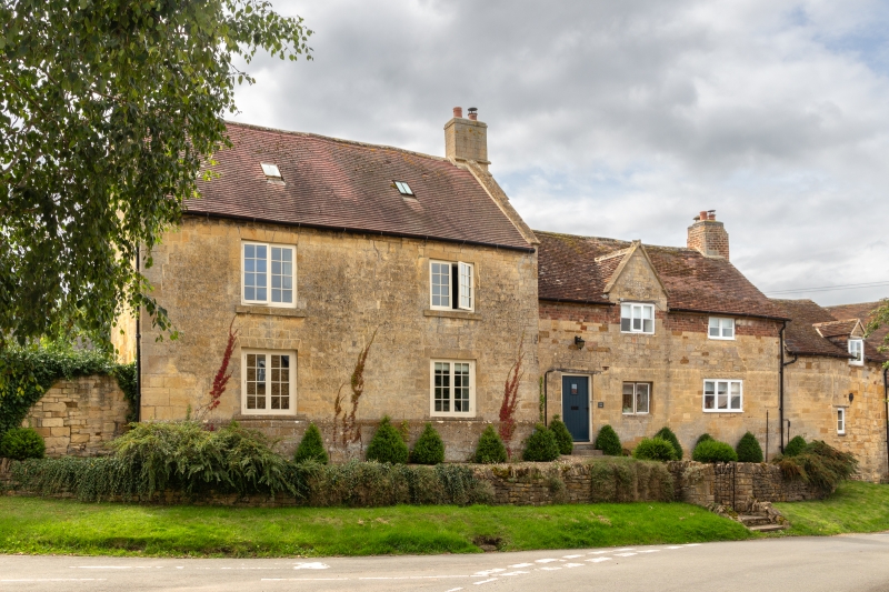
Farmhouse. Dated 1668, with late C18 addition and raised C19. Limestone ashlar with plinth, quoins and coped gable on C18 range. C17 range raised by a few courses of C19 brick. Tile roof with ashlar and brick end stacks. 2 storeys; 5-window range. Originally a 2-unit plan. To centre of C17 range a C19 plank door with wood lintel. Two C20 casements to right, and a small C19 casement to far right. To first floor a C19 three-light casement in gable with wood lintel, and datestone above, inscribed in bas-relief '16 P 68/RI'. C20 casement to right, and C20 two-light casement in small gable to far right. Late C18 range has two C20 two-light casements to each floor with original flat arches to right, and keystones to left. Interior: in C18 range 4-panelled doors. Large open fireplace with chamfered stone surround and chamfered timber bressumer. Chamfered spine beams. Stone flagged and C18 board floors. In C17 range original winder staircase to side of open fireplace. Included for group value. (V.C.H.: Warwickshire, Vol.5, p.154).
Listing NGR: SP2219038280
External links are from the relevant listing authority and, where applicable, Wikidata. Wikidata IDs may be related buildings as well as this specific building. If you want to add or update a link, you will need to do so by editing the Wikidata entry.


Other nearby listed buildings