Latitude: 52.0914 / 52°5'28"N
Longitude: -1.6905 / 1°41'25"W
OS Eastings: 421303
OS Northings: 243714
OS Grid: SP213437
Mapcode National: GBR 4MZ.Z9G
Mapcode Global: VHBYD.NP5M
Plus Code: 9C4W38R5+GR
Entry Name: The Howard Arms Inn and Attached Outbuilding Range
Listing Date: 16 May 1988
Grade: II
Source: Historic England
Source ID: 1024124
English Heritage Legacy ID: 306423
ID on this website: 101024124
Location: Ilmington, Stratford-on-Avon, Warwickshire, CV36
County: Warwickshire
District: Stratford-on-Avon
Civil Parish: Ilmington
Built-Up Area: Ilmington
Traditional County: Warwickshire
Lieutenancy Area (Ceremonial County): Warwickshire
Church of England Parish: Ilmington St Mary
Church of England Diocese: Coventry
Tagged with: Building
ILMINGTON MIDDLE STREET SP2143 (West side) 10/60 The Howard Arms Inn and attached outbuilding
GV II
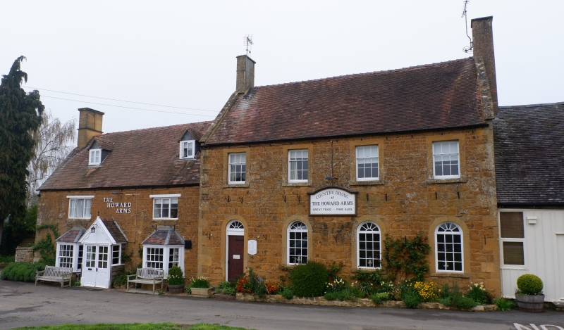
2 houses, now inn. C18 and early C19. Squared, coursed limestone with coped gables and quoins to middle range. C20 tile roof with ashlar and brick end stacks. 2 storeys; 6-window range. Range to left has C20 plank door to centre with C20 gabled porch. To left and right a canted bay with 16-pane and 8-pane sashes. To first floor left and right a C19 three-light casement with wood lintel. 2 dormers. Large range to right has plank door to left with fanlight and moulded round-headed arch. To right a range of 3 twelve-pane windows with fanlights, round-headed arches and stone sills. To first floor a range of 4 sashes, those to left the originals of 9 panes. Moulded architraves. To right a stone outbuilding range with coped gable and tile roof. 3 bays. To left a weatherboarded opening with C20 double plank doors in centre. To right a range of 2 twelve-pane windows with fanlights and moulded round-headed arches. Single double-chamfered stone light to left gable end. Interior: 2-light mullioned window in rear (now internal) wall. Outbuilding has queen strut roof with collars. Chamfered spine beans. Stone flagged floors and open fireplace, all in C18 range.
Listing NGR: SP2130343714
External links are from the relevant listing authority and, where applicable, Wikidata. Wikidata IDs may be related buildings as well as this specific building. If you want to add or update a link, you will need to do so by editing the Wikidata entry.


Other nearby listed buildings