Approximate Location Map
Large Map »
Latitude: 52.0891 / 52°5'20"N
Longitude: -1.6956 / 1°41'44"W
OS Eastings: 420953
OS Northings: 243462
OS Grid: SP209434
Mapcode National: GBR 4MZ.XTQ
Mapcode Global: VHBYD.KRGC
Plus Code: 9C4W38Q3+JQ
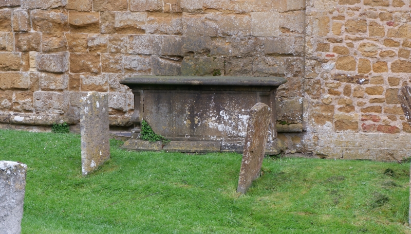
Entry Name: Chest Tomb Approximately 1.5 Metres South of Tower of Church of St Mary
Listing Date: 16 May 1988
Grade: II
Source: Historic England
Source ID: 1024127
English Heritage Legacy ID: 306432
ID on this website: 101024127
Location: St Mary's Church, Ilmington, Stratford-on-Avon, Warwickshire, CV36
County: Warwickshire
District: Stratford-on-Avon
Civil Parish: Ilmington
Built-Up Area: Ilmington
Traditional County: Warwickshire
Lieutenancy Area (Ceremonial County): Warwickshire
Church of England Parish: Ilmington St Mary
Church of England Diocese: Coventry
Tagged with: Chest tomb
ILMINGTON MIDDLE STREET
SP2043 (West side)
9/69 Chest tomb approx. 1.5m. S of
tower of Church of St. Mary
GV II
Chest tomb. Dated 1722, 1762, 1840, 1846 and 1873. Limestone, with moulded
plinth and ledger, with baluster corners. Carved panel with cartouche and putto
head and wings to west.
Listing NGR: SP2095343462
External links are from the relevant listing authority and, where applicable, Wikidata. Wikidata IDs may be related buildings as well as this specific building. If you want to add or update a link, you will need to do so by editing the Wikidata entry.


Other nearby listed buildings
