Latitude: 52.2217 / 52°13'17"N
Longitude: -1.8169 / 1°49'0"W
OS Eastings: 412603
OS Northings: 258176
OS Grid: SP126581
Mapcode National: GBR 4L8.PGV
Mapcode Global: VHB09.GFB7
Plus Code: 9C4W65CM+M6
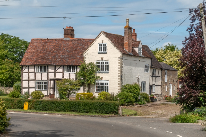
Entry Name: Walcote Farmhouse and Attached Stable
Listing Date: 1 February 1967
Last Amended: 23 October 1985
Grade: II
Source: Historic England
Source ID: 1024538
English Heritage Legacy ID: 305468
ID on this website: 101024538
Location: Walcote, Stratford-on-Avon, Warwickshire, B49
County: Warwickshire
District: Stratford-on-Avon
Civil Parish: Haselor
Traditional County: Warwickshire
Lieutenancy Area (Ceremonial County): Warwickshire
Church of England Parish: Haselor St Mary and All Saints
Church of England Diocese: Coventry
Tagged with: Farmhouse
HASELOR WALCOTE SP15NW (North side) 7/118 Walcote Farmhouse and attached 01/02/67 stable (Formerly listed as Hazelcot)
GV II
House. C17 with C18 cross wing. Timber framed with lath and plaster infill on lias plinth; cross wing of colourwashed brick with lias quoins and brick dentil cornice. Old tile roof; brick ridge, lateral and end stacks. T-plan. 2 storeys and attic; 3-window range. 6-panelled door and C20 open porch. C18/C10 casements with glazing bars. Cross wing windows have cambered brick arches with keystones. Right return side has lower timber framed section on right with leaded-light casements. Interior not inspected, but noted as having exposed framing. Stable with hayloft above attached to rear of cross wing. Coursed lias. Slate roof. Door with segmental arched head, and 2 small windows. Hayloft door.
Listing NGR: SP1260358176
External links are from the relevant listing authority and, where applicable, Wikidata. Wikidata IDs may be related buildings as well as this specific building. If you want to add or update a link, you will need to do so by editing the Wikidata entry.


Other nearby listed buildings