Latitude: 54.9734 / 54°58'24"N
Longitude: -1.6138 / 1°36'49"W
OS Eastings: 424817
OS Northings: 564374
OS Grid: NZ248643
Mapcode National: GBR SP7.B0
Mapcode Global: WHC3R.58S5
Plus Code: 9C6WX9FP+8F
Entry Name: 2-6, Nelson Street
Listing Date: 12 November 1965
Grade: II
Source: Historic England
Source ID: 1024809
English Heritage Legacy ID: 304724
ID on this website: 101024809
Location: Newcastle upon Tyne, Tyne and Wear, NE1
County: Newcastle upon Tyne
Electoral Ward/Division: Westgate
Parish: Non Civil Parish
Built-Up Area: Newcastle upon Tyne
Traditional County: Northumberland
Lieutenancy Area (Ceremonial County): Tyne and Wear
Church of England Parish: Newcastle St Andrew
Church of England Diocese: Newcastle
Tagged with: Building
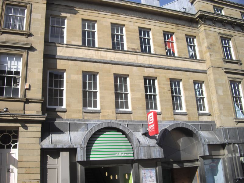
NZ 2464 SE NEWCASTLE UPON TYNE NELSON STREET (north side) 20/400 12/11/65 Nos. 2 to 6 even G.V. II Shops and houses, now shops. Circa 1836, probably by John Wardle, for Richard Grainger. Sandstone ashlar; Welsh slate roof. 3 storeys, with 4 at right; 8 bays. Ground floor altered. 2 right bays of 4 storeys have architraves to windows on tipper floors, with frieze and cornice above first-floor windows and bracketed sills to second floor, under entablature with prominent bracketed cornice. Top floor has sashes in plain reveals under cornice and blocking course. 6 recessed bays at left have first-floor aproned sills, second-floor sill string all sashes in plain reveals, some with glazing bars. First floor band to these bays; top cornice and blocking course. Later wrought iron gate in first bay.
Listing NGR: NZ2481764373
External links are from the relevant listing authority and, where applicable, Wikidata. Wikidata IDs may be related buildings as well as this specific building. If you want to add or update a link, you will need to do so by editing the Wikidata entry.


Other nearby listed buildings