Latitude: 54.9254 / 54°55'31"N
Longitude: -1.6267 / 1°37'36"W
OS Eastings: 424020
OS Northings: 559026
OS Grid: NZ240590
Mapcode National: GBR KC2H.M6
Mapcode Global: WHC3X.ZGJH
Plus Code: 9C6WW9GF+48
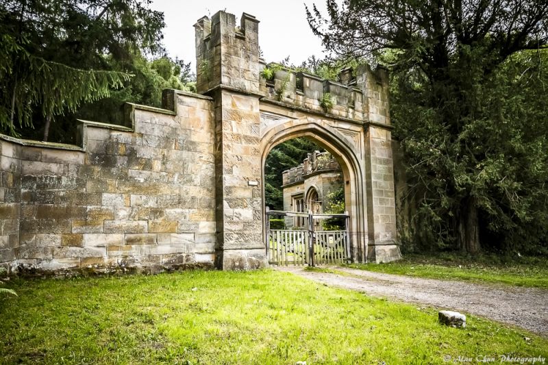
Entry Name: Arch and Walls Adjoining South Lodge
Listing Date: 18 November 1985
Grade: II
Source: Historic England
Source ID: 1025189
English Heritage Legacy ID: 303827
ID on this website: 101025189
Location: Gateshead, Tyne and Wear, NE11
County: Gateshead
Civil Parish: Lamesley
Built-Up Area: Gateshead
Traditional County: Durham
Lieutenancy Area (Ceremonial County): Tyne and Wear
Church of England Parish: Lamesley
Church of England Diocese: Durham
Tagged with: Building
NZ 25 NW LAMESLEY COACH ROAD (west side)
11/61 Arch and walls adjoining South Lodge.
G.V. II
Carriage entrance and flanking walls. 1826.Sandstone; castellated style. High moulded Tudor arch, flanked by square turrets, with patterned spandrels. Tooled ogee plinth similar to that of lodge; crenellated parapet. Coped walls step down from turrets and form canted entrance.
Listing NGR: NZ2402059026
External links are from the relevant listing authority and, where applicable, Wikidata. Wikidata IDs may be related buildings as well as this specific building. If you want to add or update a link, you will need to do so by editing the Wikidata entry.


Other nearby listed buildings