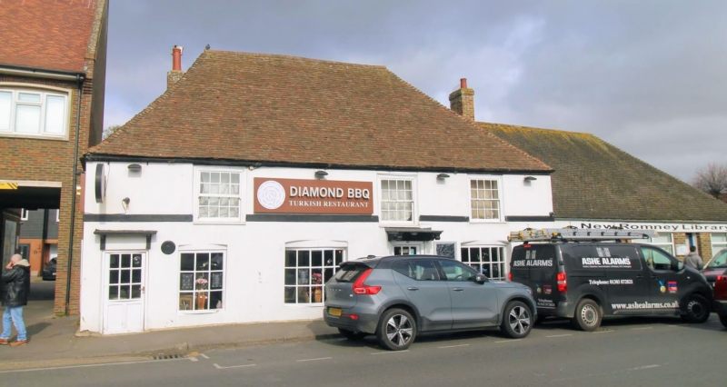
Latitude: 50.9864 / 50°59'11"N
Longitude: 0.9414 / 0°56'29"E
OS Eastings: 606542
OS Northings: 124895
OS Grid: TR065248
Mapcode National: GBR T07.4TP
Mapcode Global: FRA D6VH.QLM
Plus Code: 9F22XWPR+HH
Entry Name: Henbury Cottage Henbury House
Listing Date: 28 August 1951
Last Amended: 21 May 1973
Grade: II
Source: Historic England
Source ID: 1025290
English Heritage Legacy ID: 175052
ID on this website: 101025290
Location: New Romney, Folkestone and Hythe, Kent, TN28
County: Kent
District: Folkestone and Hythe
Civil Parish: New Romney
Built-Up Area: New Romney
Traditional County: Kent
Lieutenancy Area (Ceremonial County): Kent
Tagged with: House
1. 1449 HIGH STREET (North West Side)
No 78 (Henbury Cottage) and No 80 (Henbury House) (Formerly listed as Henbury House) TR 0624 1/17 28.8.5l.
II
2. A timber-framed building refronted in the C18. 2 storeys, now stuccoed. Steeply pitched hipped tiled roof. Stringcourse. 3 sashes with glazing bars intact. 2 doorcases in architrave surrounds with flat hoods over supported on brackets.
Listing NGR: TR0654224899
External links are from the relevant listing authority and, where applicable, Wikidata. Wikidata IDs may be related buildings as well as this specific building. If you want to add or update a link, you will need to do so by editing the Wikidata entry.


Other nearby listed buildings