Approximate Location Map
Large Map »
Latitude: 51.069 / 51°4'8"N
Longitude: 0.6886 / 0°41'18"E
OS Eastings: 588462
OS Northings: 133397
OS Grid: TQ884333
Mapcode National: GBR QW3.T21
Mapcode Global: FRA D6B9.82S
Plus Code: 9F323M9Q+HC
Entry Name: 10-14, High Street
Listing Date: 8 June 1972
Grade: II
Source: Historic England
Source ID: 1025318
English Heritage Legacy ID: 179742
ID on this website: 101025318
Location: Tenterden, Ashford, Kent, TN30
County: Kent
District: Ashford
Civil Parish: Tenterden
Built-Up Area: Tenterden
Traditional County: Kent
Lieutenancy Area (Ceremonial County): Kent
Tagged with: Building
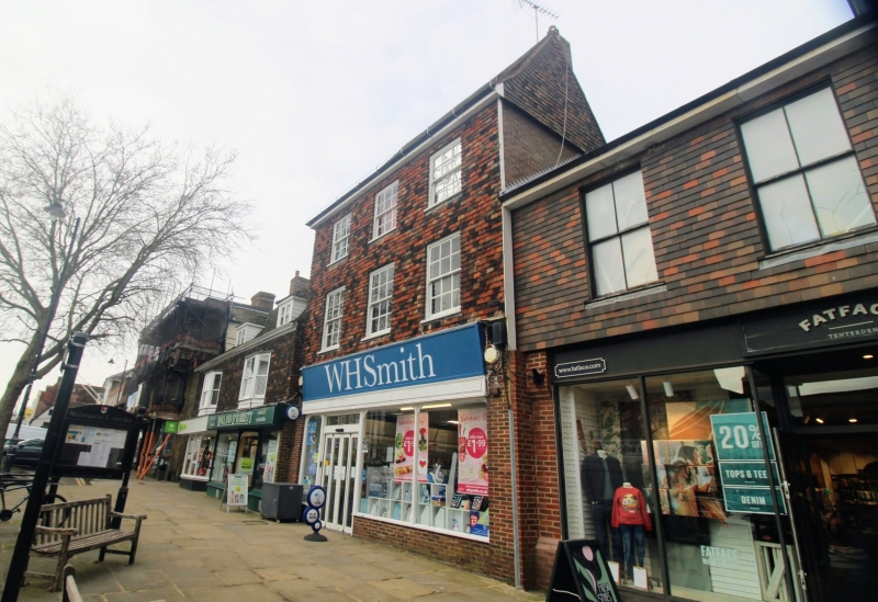
1.
1715 HIGH STREET
(North Side)
Nos 10 to 14 (even)
TQ 8833 1/30
II GV
2.
Probably a timber-framed building refronted with curved tiles in the early
C19. No 10 has 3 storeys and 3 windows, No 12 has 2 storeys and 1 window
and an attic with dormer window. Modern shop fronts. The side elevation
is weatherboarded.
All the listed buildings on the north side from Nos 10 to 44, including
Church of St Mildred form a group.
Listing NGR: TQ8846133415
External links are from the relevant listing authority and, where applicable, Wikidata. Wikidata IDs may be related buildings as well as this specific building. If you want to add or update a link, you will need to do so by editing the Wikidata entry.


Other nearby listed buildings
