Approximate Location Map
Large Map »
Latitude: 50.9307 / 50°55'50"N
Longitude: -0.1645 / 0°9'52"W
OS Eastings: 529082
OS Northings: 116182
OS Grid: TQ290161
Mapcode National: GBR JMR.F7N
Mapcode Global: FRA B6JN.5QS
Plus Code: 9C2XWRJP+75
Entry Name: Wickham Farmhouse
Listing Date: 11 May 1983
Grade: II
Source: Historic England
Source ID: 1025662
English Heritage Legacy ID: 302587
ID on this website: 101025662
Location: Hurst Wickham, Mid Sussex, BN6
County: West Sussex
District: Mid Sussex
Civil Parish: Hurstpierpoint and Sayers Common
Built-Up Area: Hurstpierpoint
Traditional County: Sussex
Lieutenancy Area (Ceremonial County): West Sussex
Church of England Parish: Hurstpierpoint
Church of England Diocese: Chichester
Tagged with: Farmhouse
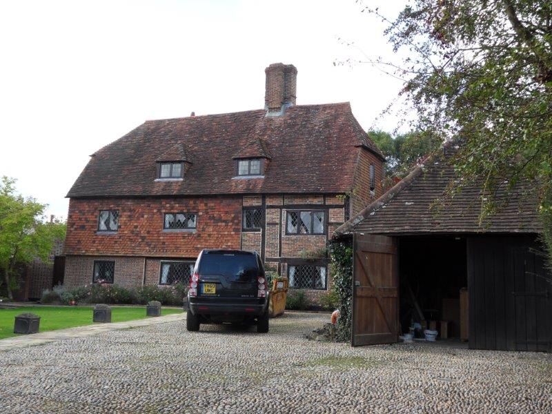
1.
5405 HURSTPIERPOINT COLLEGE LANE
No 14 (Wickham Farmhouse)
TQ 29 16 30/97
II
2.
Restored C17 or earlier timber-framed building with red brick infilling, largely
refaced with red brick and grey headers on ground floor and tile-hung above.
Half-hipped tiled roof. Casement windows. Two storeys and attic. Four windows.
Two modern dormers.
Listing NGR: TQ2908216182
External links are from the relevant listing authority and, where applicable, Wikidata. Wikidata IDs may be related buildings as well as this specific building. If you want to add or update a link, you will need to do so by editing the Wikidata entry.


Other nearby listed buildings
