Approximate Location Map
Large Map »
Latitude: 50.9518 / 50°57'6"N
Longitude: -0.7504 / 0°45'1"W
OS Eastings: 487873
OS Northings: 117674
OS Grid: SU878176
Mapcode National: GBR DFG.93M
Mapcode Global: FRA 969L.KGT
Plus Code: 9C2XX62X+PR
Entry Name: 176, the Street
Listing Date: 26 November 1987
Grade: II
Source: Historic England
Source ID: 1026072
English Heritage Legacy ID: 301613
ID on this website: 101026072
Location: Cocking, Chichester, West Sussex, GU29
County: West Sussex
District: Chichester
Civil Parish: Cocking
Built-Up Area: Cocking
Traditional County: Sussex
Lieutenancy Area (Ceremonial County): West Sussex
Church of England Parish: Cocking with West Lavington
Church of England Diocese: Chichester
Tagged with: Building
In the entry for:
HARTING THE STREET
(West side)
29/19 BAYSTOCKS
II
the entry shall be amended to read:-
HARTING THE STREET
(West side)
28/19 BYSTOCKS
II
------------------------------------
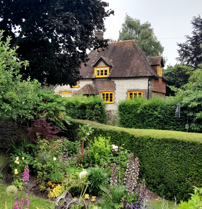
SU 8617-8717 COCKING THE STREET
(east side)
29/19 No C176 Cocking
GV II
House. C17-18. Clunch with red brick dressings quoins on a ragstone plinth. Hipped
tiled roof. One storey and attic. Three windows, casements. One gabled dormer.
Listing NGR: SU8787317674
External links are from the relevant listing authority and, where applicable, Wikidata. Wikidata IDs may be related buildings as well as this specific building. If you want to add or update a link, you will need to do so by editing the Wikidata entry.


Other nearby listed buildings
