Approximate Location Map
Large Map »
Latitude: 50.8558 / 50°51'20"N
Longitude: -0.6921 / 0°41'31"W
OS Eastings: 492156
OS Northings: 107064
OS Grid: SU921070
Mapcode National: GBR DGP.CTN
Mapcode Global: FRA 96FV.45M
Plus Code: 9C2XV845+85
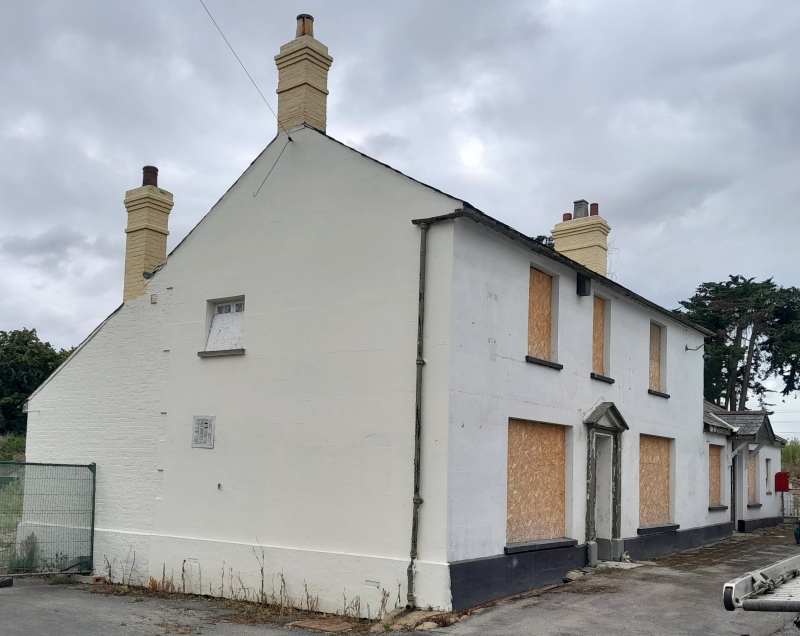
Entry Name: The Winterton Arms Public House
Listing Date: 28 January 1986
Grade: II
Source: Historic England
Source ID: 1026438
English Heritage Legacy ID: 300680
ID on this website: 101026438
Location: Crockerhill, Chichester, West Sussex, PO18
County: West Sussex
District: Chichester
Civil Parish: Boxgrove
Traditional County: Sussex
Lieutenancy Area (Ceremonial County): West Sussex
Church of England Parish: Boxgrove
Church of England Diocese: Chichester
Tagged with: Pub
BOXGROVE CROCKERHILL
SU 90 NW
14/38 The Winterton Arms
Public House
-
GV II
Early C19. Two storeys. Three windows. Stuccoed. Slate roof. Glazing
bars intact on ground floor only. Doorway with pilasters and pediment.
Listing NGR: SU9215607064
External links are from the relevant listing authority and, where applicable, Wikidata. Wikidata IDs may be related buildings as well as this specific building. If you want to add or update a link, you will need to do so by editing the Wikidata entry.


Other nearby listed buildings
