Approximate Location Map
Large Map »
Latitude: 50.8374 / 50°50'14"N
Longitude: -0.7775 / 0°46'38"W
OS Eastings: 486181
OS Northings: 104918
OS Grid: SU861049
Mapcode National: GBR DGS.G7V
Mapcode Global: FRA 968W.DXY
Plus Code: 9C2XR6PF+X2
Entry Name: The ruined walls of the former St Martin's Church
Listing Date: 8 October 1971
Grade: II
Source: Historic England
Source ID: 1026705
English Heritage Legacy ID: 300099
ID on this website: 101026705
Location: Chichester, West Sussex, PO19
County: West Sussex
District: Chichester
Civil Parish: Chichester
Built-Up Area: Chichester
Traditional County: Sussex
Lieutenancy Area (Ceremonial County): West Sussex
Church of England Parish: Chichester St Paul
Church of England Diocese: Chichester
Tagged with: Building
This list entry was subject to a Minor Amendment on 6 September 2022 to reformat the text to current standards
SU 8604 NW
4/602
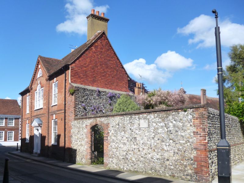
ST MARTIN'S SQUARE (East Side)
The ruined walls of the former St Martin's Church
II
Medieval flint walls of the former church, now enclosing part of a garden. Stone tablet on the west wall recording that the Parish of St Mary was amalgamated with that of St Olave.
Listing NGR: SU8618104918
External links are from the relevant listing authority and, where applicable, Wikidata. Wikidata IDs may be related buildings as well as this specific building. If you want to add or update a link, you will need to do so by editing the Wikidata entry.


Other nearby listed buildings
