Latitude: 50.8371 / 50°50'13"N
Longitude: -0.78 / 0°46'47"W
OS Eastings: 486006
OS Northings: 104878
OS Grid: SU860048
Mapcode National: GBR DGS.FN1
Mapcode Global: FRA 967W.KY3
Plus Code: 9C2XR6PC+R2
Entry Name: 30, Chapel Street
Listing Date: 8 October 1971
Grade: II
Source: Historic England
Source ID: 1026808
English Heritage Legacy ID: 299838
ID on this website: 101026808
Location: Chichester, West Sussex, PO19
County: West Sussex
District: Chichester
Civil Parish: Chichester
Built-Up Area: Chichester
Traditional County: Sussex
Lieutenancy Area (Ceremonial County): West Sussex
Church of England Parish: Chichester St Paul
Church of England Diocese: Chichester
Tagged with: Building
1.
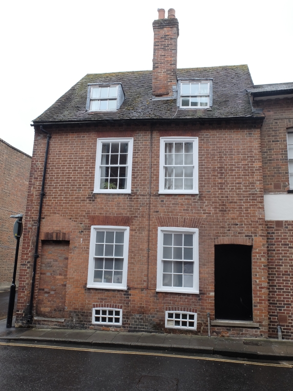
972 CHAPEL STREET
(East Side)
-------------
No 30
SU 8604 NW 4/251
II
2.
C18. Red tiled roof; overhanging eaves. Red brick. Small brick dentilled
eaves cornice. 2 storeys and attic. Flat roofed dormers. 2 windows: sash
windows in flat arches with rubbed brick voussoirs; glazing bars intact.
1 bricked up doorway at north end; 1 doorway at south end.
Listing NGR: SU8600604878
External links are from the relevant listing authority and, where applicable, Wikidata. Wikidata IDs may be related buildings as well as this specific building. If you want to add or update a link, you will need to do so by editing the Wikidata entry.


Other nearby listed buildings