Approximate Location Map
Large Map »
Latitude: 50.8906 / 50°53'26"N
Longitude: -0.332 / 0°19'55"W
OS Eastings: 517412
OS Northings: 111451
OS Grid: TQ174114
Mapcode National: GBR HLS.0WW
Mapcode Global: FRA B66R.6GS
Plus Code: 9C2XVMR9+65
Entry Name: Mill House
Listing Date: 9 May 1980
Grade: II
Source: Historic England
Source ID: 1027279
English Heritage Legacy ID: 298720
ID on this website: 101027279
Location: Steyning, Horsham, West Sussex, BN44
County: West Sussex
District: Horsham
Civil Parish: Steyning
Built-Up Area: Steyning
Traditional County: Sussex
Lieutenancy Area (Ceremonial County): West Sussex
Church of England Parish: Steyning St Andrew
Church of England Diocese: Chichester
Tagged with: House
STEYNING HIGH STREET
1. (north-east side)
5404
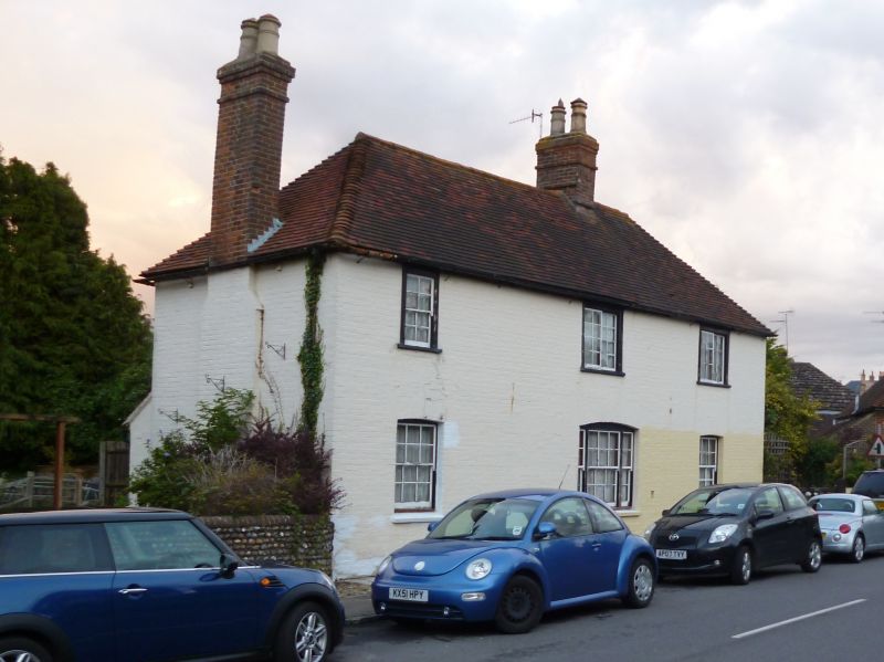
No 126 (Mill House)
TQ 1711 24/115
II GV
2.
C18. Two storeys. Three windows. Painted brick. Hipped tiled roof.
Horizontally-sliding sash windows on first floor, two ordinary sash windows
with glazing bars intact and one modern window on ground floor.
Listing NGR: TQ1741211451
External links are from the relevant listing authority and, where applicable, Wikidata. Wikidata IDs may be related buildings as well as this specific building. If you want to add or update a link, you will need to do so by editing the Wikidata entry.


Other nearby listed buildings
