Latitude: 50.8871 / 50°53'13"N
Longitude: -0.327 / 0°19'37"W
OS Eastings: 517774
OS Northings: 111067
OS Grid: TQ177110
Mapcode National: GBR HLS.850
Mapcode Global: FRA B66R.GG5
Plus Code: 9C2XVMPF+R6
Entry Name: Charlton House and Garden Wall, Gate and Railings to North East
Listing Date: 15 March 1955
Grade: II*
Source: Historic England
Source ID: 1027280
English Heritage Legacy ID: 298724
ID on this website: 101027280
Location: Steyning, Horsham, West Sussex, BN44
County: West Sussex
District: Horsham
Civil Parish: Steyning
Built-Up Area: Steyning
Traditional County: Sussex
Lieutenancy Area (Ceremonial County): West Sussex
Church of England Parish: Steyning St Andrew
Church of England Diocese: Chichester
Tagged with: House
STEYNING HIGH STREET 1. (south-west side) 5404 No 5 (Charlton House) and garden wall, gate and railings to north-east TQ 1711 24/119 15.3.55
II* GV
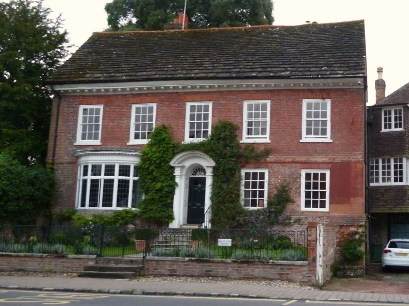
2. Early C18. Two storeys. Five windows. Red brick. Stringcourse. Eaves bracket cornice. Horsham slab roof. Modern five-light bay window on ground floor to south of doorway. Glazing bars otherwise intact. Doorway with fluted columns with fancy capitals of roses and plumes, curved pediment, semi-circular fanlight and door of 6 fielded panels, top two glazed, the whole set at head of seven steps with iron handrail. This house was originally the residence of the brewer who owned the former brewery adjoining. The garden is enclosed to the north-east by a contemporary iron railing and gate standing on a low brick wall.
Listing NGR: TQ1777411067
External links are from the relevant listing authority and, where applicable, Wikidata. Wikidata IDs may be related buildings as well as this specific building. If you want to add or update a link, you will need to do so by editing the Wikidata entry.


Other nearby listed buildings